PO Box 773, Elizabethtown | (518) 637-8075
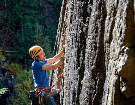
The premier guide service in the Adirondacks for rock climbing, ice climbing, technical mountaineering and slide climbing. We are the only guide service based in the Adirondacks with all AMGA (American Mountain Guides Association) trained and...
Guide Services
1d1efd89-3e74-4d09-bfa2-e8960dc009b0
21 Grandview Drive, Crown Point | (518) 597-4666
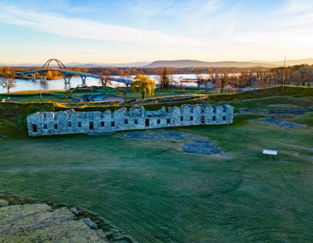
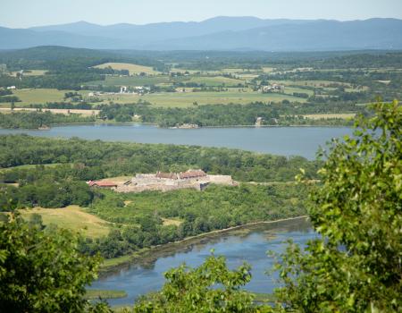
The historic Crown Point is definitely a "don't miss" stop in the Lake Champlain Region! The grounds are free to explore, but there is an admission fee at museum.
8ac44921-7798-4055-9c87-05d19eefb6c6
PO Box 773, Elizabethtown | (518) 637-8075
The premier guide service in the Adirondacks for rock climbing, ice climbing, technical mountaineering and slide climbing. We are the only guide service based in the Adirondacks with all AMGA (American Mountain Guides Association) trained and...
Guide Services
1d1efd89-3e74-4d09-bfa2-e8960dc009b0
21 Grandview Drive, Crown Point | (518) 597-4666
The historic Crown Point is definitely a "don't miss" stop in the Lake Champlain Region! The grounds are free to explore, but there is an admission fee at museum.
History
8ac44921-7798-4055-9c87-05d19eefb6c6
PO Box 773, Elizabethtown | (518) 637-8075
The premier guide service in the Adirondacks for rock climbing, ice climbing, technical mountaineering and slide climbing. We are the only guide service based in the Adirondacks with all AMGA (American Mountain Guides Association) trained and...
Guide Services
1d1efd89-3e74-4d09-bfa2-e8960dc009b0
PO Box 773, Elizabethtown | (518) 637-8075
The premier guide service in the Adirondacks for rock climbing, ice climbing, technical mountaineering and slide climbing. We are the only guide service based in the Adirondacks with all AMGA (American Mountain Guides Association) trained and...
1d1efd89-3e74-4d09-bfa2-e8960dc009b0
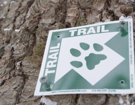
6482 Main Street, Westport | (518) 962-2287
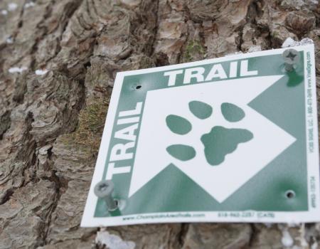
200 miles of trails In 2009, Champlain Area Trails (CATS) trail published its earliest trail map highlighting the first new hiking trails it created along with the few existing other trails. This gave visitors and residents alike a new perspective on...
Hiking
cbf7b286-f8bf-4cf3-b26f-4290e3a4ffa3
21 Grandview Drive, Crown Point | (518) 597-4666
The historic Crown Point is definitely a "don't miss" stop in the Lake Champlain Region! The grounds are free to explore, but there is an admission fee at museum.
Weddings
8ac44921-7798-4055-9c87-05d19eefb6c6
21 Grandview Drive, Crown Point | (518) 597-4666
The historic Crown Point is definitely a "don't miss" stop in the Lake Champlain Region! The grounds are free to explore, but there is an admission fee at museum.
Hiking
8ac44921-7798-4055-9c87-05d19eefb6c6
21 Grandview Drive, Crown Point | (518) 597-4666
The historic Crown Point is definitely a "don't miss" stop in the Lake Champlain Region! The grounds are free to explore, but there is an admission fee at museum.
History
8ac44921-7798-4055-9c87-05d19eefb6c6
PO Box 773, Elizabethtown | (518) 637-8075
The premier guide service in the Adirondacks for rock climbing, ice climbing, technical mountaineering and slide climbing. We are the only guide service based in the Adirondacks with all AMGA (American Mountain Guides Association) trained and...
1d1efd89-3e74-4d09-bfa2-e8960dc009b0
21 Grandview Drive, Crown Point | (518) 597-4666
The historic Crown Point is definitely a "don't miss" stop in the Lake Champlain Region! The grounds are free to explore, but there is an admission fee at museum.
Cross Country Skiing
8ac44921-7798-4055-9c87-05d19eefb6c6
21 Grandview Drive, Crown Point | (518) 597-4666
The historic Crown Point is definitely a "don't miss" stop in the Lake Champlain Region! The grounds are free to explore, but there is an admission fee at museum.
Snowshoeing
8ac44921-7798-4055-9c87-05d19eefb6c6
4317 Main St, Suite 1, Port Henry | (518) 250-1050
To complete the "Moriah Challenge" hikers must complete all four local Champlain Area Trails (CATS) hikes, which include Belfry Mountain, Big Hollow/Coot Hill, Cheney Mountain, and Crowfoot Pond trails. Anyone who successfully completes the challenge...
Hiking
f438b0ba-ebc6-46b9-b5e7-eaadae8dad2a
6482 Main Street, Westport | (518) 962-2287
200 miles of trails In 2009, Champlain Area Trails (CATS) trail published its earliest trail map highlighting the first new hiking trails it created along with the few existing other trails. This gave visitors and residents alike a new perspective on...
cbf7b286-f8bf-4cf3-b26f-4290e3a4ffa3
21 Grandview Drive, Crown Point | (518) 597-4666
The historic Crown Point is definitely a "don't miss" stop in the Lake Champlain Region! The grounds are free to explore, but there is an admission fee at museum.
Weddings
8ac44921-7798-4055-9c87-05d19eefb6c6
Route 9, New Russia
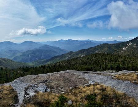
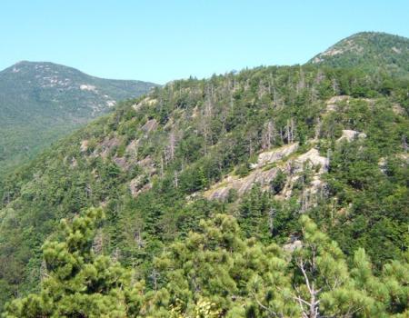
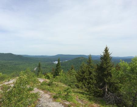
Hiking Rocky Peak Ridge is the 20th highest peak in the Adirondacks at 4,420 feet in elevation. It offers outstanding views from its summit, and is usually less-crowded than neighboring Giant.
Campgrounds
73ee7918-916d-4b57-a716-942e56669a79
Route 22, Westport
Explore the hidden quarry! This loop trail explores two delightful little forest areas and a field, with old cement structures from the turn of the previous century.
a5f60b08-80e5-4208-8418-a1ed1a57193d
Lake Shore Rd, Westport
This trail leaves from Gary’s Elbow and the Calamity Trail and is used as a cross-over trail to access both sides of Split Rock Wild Forest.
Hiking
dd9f58a0-6eb8-4b69-97bd-f1b477f3b92b
763 Putts Pond Road, Ticonderoga
Crane Pond is a beautiful gem in the Pharaoh Lake Wilderness.
Fishing
b149c6a1-0f6c-4eef-a456-dda74d3b4c34
Ensign Pond Road POB 193, Port Henry
The Round Pond Trail connects Ensign Pond Road with the area near Sharp Bridge State Campground, bisecting a portion of the Hammond Pond Wild Forest.
Hiking
cd8ecd80-a268-443b-9fdc-855f51dea92f
Route 9, Elizabethtown
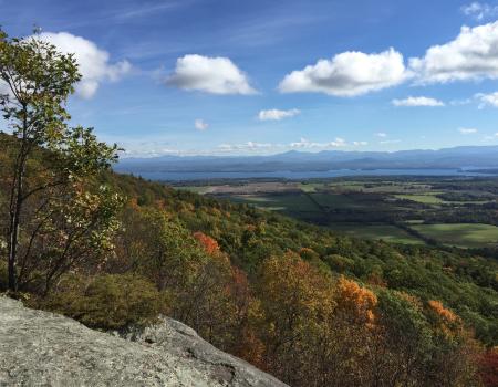
Giant is a shortened name for the peak that was originally called Giant of the Valley, and that's exactly what it is — a huge landmass that towers over Keene Valley and the surrounding lowlands.
Snowshoeing
54d39abe-36d6-4b9d-8504-8eaaa2cec46b
Cook Rd/Walker Rd, Essex
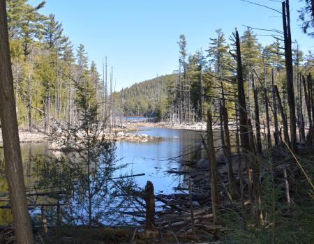
The Beaver Flow Trail is a flat, easy snowshoe route that meanders through a mixed forest and runs parallel to a small waterway.
Snowshoeing
114ad94f-807e-44f8-b450-3d84bdc4c2d1
Route 9, Keeseville
Poke-O-Moonshine Mountain has a commanding summit view which gets even better when the fire tower is open. There's 360 degree views of the High Peaks and Green Mountains in Vermont, Lake Champlain, and the Champlain Valley.
ba0c97ad-593d-4b70-a1f0-abe0e0dbfa30
Bronson Way , Elizabethtown
The Blueberry Hill Trails are located in the Town of Elizabethtown and were built for hiking, snowshoeing, mountain biking, horseback riding, and cross country skiing. There are several other viewing areas within the trail system that are quite rewarding.
Hiking
48d20e41-f049-4be8-8ce7-998b725b6009
Tracy Road, Mineville
This is a pleasant trail through woods and small hills. It's an easy, 1-mile loop.
Hiking
60b8334c-fc05-46fb-a7cf-e87f44b08e32
4525 NYS Route 22 (across the road), Willsboro
This mountain is well-known for offering great "value for effort." There are spectacular views of the entire area from the top.
Hiking
3db74752-2464-4bef-a912-d0a177b7ad65
CR 54, Port Henry
Cheney Mountain is a short, and sometimes steep, hike up a local favorite.
Hiking
a7510460-fbd3-4621-aa03-fd048b96f1c2
729 County Hwy 7C, Mineville
Known as the easiest fire tower in the Adirondacks, Belfry is excellent for any age or skill level. While this entire climb is uphill along an access road to the tower, it is very easy and has little elevation change.
Hiking
d56786cd-951c-42b4-bacf-00d92c1af868
Cook Road, Essex
Originally an old road, this 1.5-mile long trail offers an easy incline through the woods.
Hiking
60d18e80-9cef-48ed-871d-a4f50ebabe04
763 Putts Pond Road, Ticonderoga
For a short but sweet walk in the wilderness, check out the Grizzle Ocean loop in the Pharaoh Lake Wilderness Area.
Campgrounds
2b7db099-b476-4f0a-9fe8-5976a17b0da4
Route 9, New Russia
This aptly-named mountain is the first summit on the East Trail to Rocky Peak and Giant at 1.9 miles from Rt. 9.
Snowshoeing
f4b4e0de-66ab-4e69-8e8d-6943d6a62680
Route 9, Elizabethtown
Giant is a shortened name for the peak that was originally called Giant of the Valley, and that's exactly what it is — a huge landmass that towers over Keene Valley and the surrounding lowlands.
Hiking
54d39abe-36d6-4b9d-8504-8eaaa2cec46b
Route 9, Keeseville
Poke-O-Moonshine Mountain has a commanding summit view which gets even better when the fire tower is open. There's 360 degree views of the High Peaks and Green Mountains in Vermont, Lake Champlain, and the Champlain Valley.
Snowshoeing
ba0c97ad-593d-4b70-a1f0-abe0e0dbfa30
Brookfield Road, Essex
The Split Rock Wildway is a "wildlife corridor" between Lake Champlain and the Adirondack Mountains. A fairly easy climb rewards with incredible views of the valley and all its passages.
Snowshoeing
60426e04-f96c-477e-b792-6d2bed8e5d23
154-166 Soper Rd Giddings Road Trailhead, Keeseville
This is a great place for hiking, birding, cross- country skiing, and snowshoeing! There is also a wheelchair accessible trail.
Snowshoeing
cd58dc2a-9010-40b8-bf48-5656d0cc9f69
763 Putts Pond Road, Ticonderoga
Crane Pond is a beautiful gem in the Pharaoh Lake Wilderness.
Snowshoeing
b149c6a1-0f6c-4eef-a456-dda74d3b4c34
Overlooking Fort Ticonderoga and Lake Champlain, Ticonderoga
Mount Defiance, owned by Fort Ticonderoga, has a toll road to its historic summit. An interpretive tour is provided daily at the summit at 4 p.m. during the Fort's open season.
Hiking
e6a7d8c1-1ebf-4862-abcd-14fee6753b5d
Leaning Road POB 193, Essex
The hike goes through woods, along up and down a rocky slope, crosses a stream, wetlands and fields.
0288814b-b751-4f72-9782-3fee7d8966af
Moriah
This new trail features a historic cemetery and a large summit expanse, with views from angles not easily reached by any other trail.
Hiking
499f651c-7005-42ff-9381-16c2121df47b
Angier Hill Road POB 193, Whallonsburg
The Beaver Bend Trail is a short half-mile loop along the Boquet River that includes views of the river, signs of beaver activity, and a floodplain forest.
Hiking
31bc402a-f6a8-4abf-a5a4-163e8d2482c7
Leaning Road POB 193, Essex
The hike goes through woods, along up and down a rocky slope, crosses a stream, wetlands and fields.
0288814b-b751-4f72-9782-3fee7d8966af
154-166 Soper Rd Giddings Road Trailhead, Keeseville
This is a great place for hiking, birding, cross- country skiing, and snowshoeing! There is also a wheelchair accessible trail.
Hiking
cd58dc2a-9010-40b8-bf48-5656d0cc9f69
Route 9, Elizabethtown
Giant is a shortened name for the peak that was originally called Giant of the Valley, and that's exactly what it is — a huge landmass that towers over Keene Valley and the surrounding lowlands.
Hiking
54d39abe-36d6-4b9d-8504-8eaaa2cec46b
Putts Pond Rd, Ticonderoga
Berrymill Pond is a scenic destination with hiking, camping, and paddling!
Campgrounds
a235d962-f4b7-4525-bbcf-5eb376bba276
763 Putts Pond Road, Ticonderoga
Crane Pond is a beautiful gem in the Pharaoh Lake Wilderness.
Campgrounds
b149c6a1-0f6c-4eef-a456-dda74d3b4c34
., Lake Placid
The High Peaks Wilderness Area is the largest Wilderness Area in the Adirondack Mountains and New York state.
Campgrounds
bf01cf76-4780-44fe-b6c1-a2c0a41b2b30
Route 9, Elizabethtown
Mount Gilligan is a somewhat popular climb with really nice views of the Giant Mountain Wilderness.
Hiking
ca49dcf7-6ee1-4566-a146-a77f87715cd8
Crown Point State Historic Site Grand View Drive, Crown Point
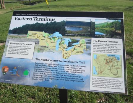
The North Country National Scenic Trail is America's longest National Scenic Trail stretching 4,600 miles from Vermont to North Dakota, linking seven states, 10 National Forests, and more than 150 public lands.
Hiking
aa3504f8-6392-4747-bca1-2a8148cddd6e
Route 22, Essex
This lovely trail goes through a forest and a field, then goes along wetlands and a pond before entering a diverse forest with incredibly old oak trees and unexpected rock outcrops.
Hiking
1f1f3585-1a84-43e1-a2e3-3e99b16807d9
Lake Shore Rd, Westport
The trail climbs slightly from the trailhead and passes by a trail on the right that leads to Gary's Elbow. Continue straight ahead and take the next left at the top of the hill. The trail continues to climb moderately for just over a half mile to a...
Snowshoeing
f24a9460-7e96-4109-b84c-e1232d9e5041
Route 9, New Russia
Hiking Rocky Peak Ridge is the 20th highest peak in the Adirondacks at 4,420 feet in elevation. It offers outstanding views from its summit, and is usually less-crowded than neighboring Giant.
Snowshoeing
73ee7918-916d-4b57-a716-942e56669a79
Route 22, Essex
This lovely trail goes through a forest and a field, then goes along wetlands and a pond before entering a diverse forest with incredibly old oak trees and unexpected rock outcrops.
Cross Country Skiing
1f1f3585-1a84-43e1-a2e3-3e99b16807d9
Elizabethtown-Wadhams Road POB 193, Elizabethtown
This is a short hike through the woods above the Boquet River.
Hiking
6bd58ec8-d77c-4e11-a9d1-72339d7d4f2c
Putts Pond Rd, Ticonderoga
This small peak has some of the best views in the area and is quite a popular hike when the Putnam Pond DEC Campground is open.
Paddling
41f85e6f-3a52-43e6-b679-e74a24b3fb5c
Route 9, Elizabethtown
Giant is a shortened name for the peak that was originally called Giant of the Valley, and that's exactly what it is — a huge landmass that towers over Keene Valley and the surrounding lowlands.
Snowshoeing
54d39abe-36d6-4b9d-8504-8eaaa2cec46b
Route 9N, Ticonderoga
Deer Leap is more of a cliff over the lake and resides lower than the actual hill.
Hiking
c60b3d69-70eb-4aed-b5cc-98b8337d00b3
4363 Lincoln Pond Road, Elizabethtown
While the wild forest designation allows this area a higher degree of human interaction, the trails in Hammond Pond are not as heavily traveled as nearby wilderness areas and you can find some solitude here.
dad8f79f-e41b-476f-a42e-aeb52e3a7c72
Cook Rd/Walker Rd, Essex
The Beaver Flow Trail is a flat, easy snowshoe route that meanders through a mixed forest and runs parallel to a small waterway.
114ad94f-807e-44f8-b450-3d84bdc4c2d1
Bronson Way , Elizabethtown
The Blueberry Hill Trails are located in the Town of Elizabethtown and were built for hiking, snowshoeing, mountain biking, horseback riding, and cross country skiing. There are several other viewing areas within the trail system that are quite rewarding.
Cross Country Skiing
48d20e41-f049-4be8-8ce7-998b725b6009
Crown Point
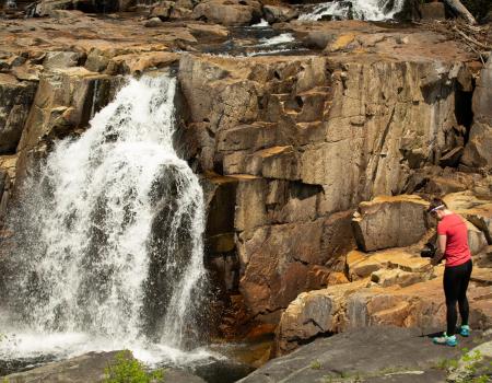
Stair Falls, also known as Staircase Falls, is located on Putnam Creek along with a series of other falls. This charming series of falls cascades over stair-like steps, which is how it got it's name. While you're on the lookout for all the Falls...
Hiking
1d213418-5463-4b62-85de-c404e87630b6
., Lake Placid
The High Peaks Wilderness Area is the largest Wilderness Area in the Adirondack Mountains and New York state.
bf01cf76-4780-44fe-b6c1-a2c0a41b2b30
763 Putts Pond Road, Ticonderoga
Crane Pond is a beautiful gem in the Pharaoh Lake Wilderness.
Cross Country Skiing
b149c6a1-0f6c-4eef-a456-dda74d3b4c34
Route 9, Elizabethtown
Giant is a shortened name for the peak that was originally called Giant of the Valley, and that's exactly what it is — a huge landmass that towers over Keene Valley and the surrounding lowlands.
Hiking
54d39abe-36d6-4b9d-8504-8eaaa2cec46b
763 Putts Pond Road, Ticonderoga
For a short but sweet walk in the wilderness, check out the Grizzle Ocean loop in the Pharaoh Lake Wilderness Area.
Hiking
2b7db099-b476-4f0a-9fe8-5976a17b0da4
763 Putts Pond Road, Ticonderoga
Crane Pond is a beautiful gem in the Pharaoh Lake Wilderness.
Fishing
b149c6a1-0f6c-4eef-a456-dda74d3b4c34
Bicentennial Park, Ticonderoga
Take a lovely loop around Bicentennial Park in Ticonderoga with many interpretive signboards to learn about history and nature.
c40f50ba-e0a9-4243-8815-29dc25f86100
763 Putts Pond Road, Ticonderoga
For a short but sweet walk in the wilderness, check out the Grizzle Ocean loop in the Pharaoh Lake Wilderness Area.
Snowshoeing
2b7db099-b476-4f0a-9fe8-5976a17b0da4
County Highway 12, Essex
A wide variety of habitat, from an old logging road through the forest to traversing slopes and walking beneath rock ledges.
Hiking
90338cd1-233c-4a25-9768-5ed1a961a1c1
Route 9N POB 193, Westport
The DaCy Meadow Farm Trail is an easy, 2-mile loop that goes through a field, passes over a stream and wetland, goes uphill through a forest, and then back down to follow a stream.
Hiking
2eda04b2-b160-4f66-a54f-7908de657b6c
Route 9, New Russia
This aptly-named mountain is the first summit on the East Trail to Rocky Peak and Giant at 1.9 miles from Rt. 9.
Hiking
f4b4e0de-66ab-4e69-8e8d-6943d6a62680
Stevenson Road, Westport
The Mountain Spring Road Trail is an easy, 8-mile-loop that follows a seasonal road through the Adirondack foothills, known as the West Champlain Hills, to Mineville.
Hiking
3a9fa7bc-39aa-4d77-8688-5f0fec0c9846
Route 9N, Ticonderoga
Brown Mountain a great destination or can be made part of a longer trip. Either way, you can't go wrong. And the views are superb!
Hiking
0f077d6a-6c29-45e1-ad42-67aa3450ef29
., Lake Placid
The High Peaks Wilderness Area is the largest Wilderness Area in the Adirondack Mountains and New York state.
bf01cf76-4780-44fe-b6c1-a2c0a41b2b30
Walker Road/Sayre Road, Westport
The easy trail trail goes through a meadow, winds through mixed forest, and ends at another meadow. It joins the Beaver Flow Trail at its northern trailhead. Bobcat Trailhead: This trail can be approached from either end. The north end starts on...
Hiking
8f732acb-f5a1-4782-a0e6-79fd3ef6896a
Wadhams
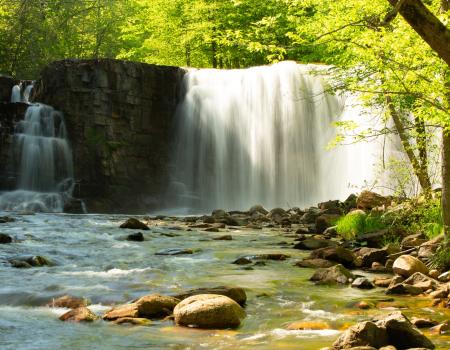
Wadhams Falls is a large flume falls on the Bouquet River in the center of Wadhams. This waterfall is visible from the road, Rt 22, which makes it a perfect stop for families. This beautiful little water fall has been generating electrical power for...
Hiking
1278d72a-7a29-4805-9d72-f40361cebea3
Baldwin Road, Ticonderoga
The Cook Mountain Preserve covers 200 acres with a wide variety of terrain. The summit of the mountain offers views of Lake George, the Champlain Valley, and Vermont's Green Mountains.
6c580f72-d4a4-43fc-bd75-9216413d6b9d
Lake Shore Road, Westport
Barn Rock is a massive rocky outcropping overlooking Lake Champlain, and is a worthy destination for the view of and from the bay's namesake.
Hiking
fdd7d8b1-06d7-4adf-8677-704f33c17236
Lake Shore Road, Westport
The largest undeveloped tract of land on the Lake Champlain shoreline, Split Rock Wild Forest covers 3,700 acres in the towns of Essex and Westport. There was plenty of trails to explore in the area!
Snowshoeing
33e6aa61-00ef-4339-a2b9-535f1b6be191
Route 9, New Russia
Hiking Rocky Peak Ridge is the 20th highest peak in the Adirondacks at 4,420 feet in elevation. It offers outstanding views from its summit, and is usually less-crowded than neighboring Giant.
Hiking
73ee7918-916d-4b57-a716-942e56669a79
Route 74, Ticonderoga
Bear Pond is a fine wilderness destination that doesn't require much effort!
Hiking
67ccf1c6-683f-43c3-8d37-e2ad49bb2a75
Lake Shore Road, Westport
The largest undeveloped tract of land on the Lake Champlain shoreline, Split Rock Wild Forest covers 3,700 acres in the towns of Essex and Westport. There was plenty of trails to explore in the area!
Cross Country Skiing
33e6aa61-00ef-4339-a2b9-535f1b6be191
Brookfield Road, Essex
The Split Rock Wildway is a "wildlife corridor" between Lake Champlain and the Adirondack Mountains. A fairly easy climb rewards with incredible views of the valley and all its passages.
Hiking
60426e04-f96c-477e-b792-6d2bed8e5d23
763 Putts Pond Road, Ticonderoga
Crane Pond is a beautiful gem in the Pharaoh Lake Wilderness.
Hiking
b149c6a1-0f6c-4eef-a456-dda74d3b4c34
763 Putts Pond Road, Ticonderoga
Clear Pond is as quiet a pond as you will find anywhere, and although many hikers use the trails surrounding the pond, very few access it by boat. Use the area trails to extend your adventure, and even consider a second carry to Rock Pond to the north.
Fishing
e458a742-3159-4522-840c-a2a759454327
Lake Shore Road, Westport
The largest undeveloped tract of land on the Lake Champlain shoreline, Split Rock Wild Forest covers 3,700 acres in the towns of Essex and Westport. There was plenty of trails to explore in the area!
33e6aa61-00ef-4339-a2b9-535f1b6be191
763 Putts Pond Road, Ticonderoga
Crane Pond is a beautiful gem in the Pharaoh Lake Wilderness.
Paddling
b149c6a1-0f6c-4eef-a456-dda74d3b4c34
Ensign Pond Road POB 193, Moriah
There is a slight incline to this hike but it's very pretty and a relaxing hike. The pond gets its name from an early pioneer named Timothy Challis.
Hiking
f11a7462-d106-457d-bc08-1df2c1d295f7
Crane Pond Road, Ticonderoga
The 46,283-acre Pharaoh Lake Wilderness is an outstanding part of the Adirondacks! The wilderness contains an abundance of lakes and ponds, the largest being Pharaoh Lake, at 441 acres. There are nearly 70- miles of trails within the Wilderness.
Hiking
00a24047-a95b-4f0d-8b90-010af07eff96
Route 9, New Russia
Hiking Rocky Peak Ridge is the 20th highest peak in the Adirondacks at 4,420 feet in elevation. It offers outstanding views from its summit, and is usually less-crowded than neighboring Giant.
Snowshoeing
73ee7918-916d-4b57-a716-942e56669a79
Bicentennial Park, Ticonderoga
Take a lovely loop around Bicentennial Park in Ticonderoga with many interpretive signboards to learn about history and nature.
c40f50ba-e0a9-4243-8815-29dc25f86100
Trout Pond Road, Keeseville
Explore a wilderness preserve and hike a trail to a remote pond.
7db857ad-858f-4c7c-952e-e44c47246219
Bronson Way , Elizabethtown
The Blueberry Hill Trails are located in the Town of Elizabethtown and were built for hiking, snowshoeing, mountain biking, horseback riding, and cross country skiing. There are several other viewing areas within the trail system that are quite rewarding.
Running
48d20e41-f049-4be8-8ce7-998b725b6009
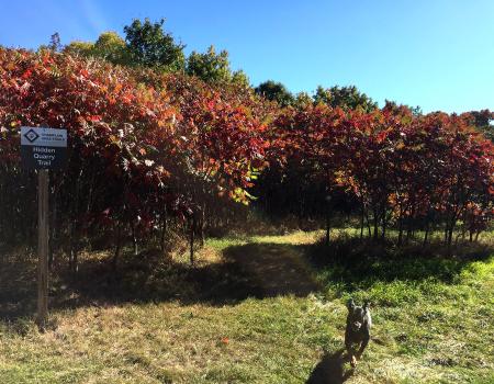
Route 22, Westport
Explore the hidden quarry! This loop trail explores two delightful little forest areas and a field, with old cement structures from the turn of the previous century.
a5f60b08-80e5-4208-8418-a1ed1a57193d
Bronson Way , Elizabethtown
The Blueberry Hill Trails are located in the Town of Elizabethtown and were built for hiking, snowshoeing, mountain biking, horseback riding, and cross country skiing. There are several other viewing areas within the trail system that are quite rewarding.
Cycling
48d20e41-f049-4be8-8ce7-998b725b6009
Route 9, Keeseville
Poke-O-Moonshine Mountain has a commanding summit view which gets even better when the fire tower is open. There's 360 degree views of the High Peaks and Green Mountains in Vermont, Lake Champlain, and the Champlain Valley.
Hiking
ba0c97ad-593d-4b70-a1f0-abe0e0dbfa30
State Route 2, Crown Point
The trail follows a road for 0.1 mile. Take the right fork onto an old road, which goes through an attractive forest.
Hiking
8650625a-460e-4d9b-8c79-2ea14ee0169e
Route 9N, Keene
This is a wonderful open peak with a restored firetower that can be climbed, even though the tower is not needed for some of the best views in the High Peaks.
Hiking
6ea9fda2-fc26-4741-93e2-dfa60ad4f5b5
Halds Rd, Westport
Coon Mountain is on the Coon Mountain Preserve, which is owned by the Adirondack Land Trust. This is a perfect family outing, and if you are in the area it should not be missed
Hiking
0d84f284-69d8-40ba-b27f-8b86e0dfbf05
Moriah
This new trail features a historic cemetery and a large summit expanse, with views from angles not easily reached by any other trail.
499f651c-7005-42ff-9381-16c2121df47b
Reber Road, Willsboro
This easy, 4-mile round-trip trail follows an abandoned road through the forest west of Long Pond in the town of Willsboro. The south trailhead on Reber Road is 1.7 miles west of Route 22. The north trailhead on Carver Road is 0.8 mile west of Route 22.
Hiking
33c31e8b-ac22-41a6-aecd-9e3b0ac57d43
6482 Main Street POB 193, Westport
Hike them both or just one. Either way, these two ponds are attractive destinations. They are definitely not all day adventures, but make for a good place to stretch your legs.
Hiking
74b54b8a-2d94-4d1c-a346-c37119aa9194
6475 U.S. 9, Elizabethtown
Owl Head Lookout is a true hidden gem, and should not be overlooked! In any season, but especially in fall, the views of the sweeping forest will absolutely take your breath away.
Snowshoeing
d979f21e-eabd-4985-97f6-963f0d438e8f
Trout Pond Road, Keeseville
Explore a wilderness preserve and hike a trail to a remote pond.
7db857ad-858f-4c7c-952e-e44c47246219
Putts Pond Rd, Ticonderoga
Berrymill Pond is a scenic destination with hiking, camping, and paddling!
Paddling
a235d962-f4b7-4525-bbcf-5eb376bba276
Crane Pond Road, Ticonderoga
The 46,283-acre Pharaoh Lake Wilderness is an outstanding part of the Adirondacks! The wilderness contains an abundance of lakes and ponds, the largest being Pharaoh Lake, at 441 acres. There are nearly 70- miles of trails within the Wilderness.
00a24047-a95b-4f0d-8b90-010af07eff96
Bronson Way , Elizabethtown
The Blueberry Hill Trails are located in the Town of Elizabethtown and were built for hiking, snowshoeing, mountain biking, horseback riding, and cross country skiing. There are several other viewing areas within the trail system that are quite rewarding.
Snowshoeing
48d20e41-f049-4be8-8ce7-998b725b6009
Essex Road, Essex
This is another fine trail in the CATS network. The Sophie's Lair Trail goes through a field, then enters the woods with two loops and a connection to the Florence Hathaway Park Trail.
Hiking
d8f89a1f-1dcf-4871-a206-9a96f26c46ef
Route 9, New Russia
Hiking Rocky Peak Ridge is the 20th highest peak in the Adirondacks at 4,420 feet in elevation. It offers outstanding views from its summit, and is usually less-crowded than neighboring Giant.
Campgrounds
73ee7918-916d-4b57-a716-942e56669a79
Route 9, New Russia
Hiking Rocky Peak Ridge is the 20th highest peak in the Adirondacks at 4,420 feet in elevation. It offers outstanding views from its summit, and is usually less-crowded than neighboring Giant.
Hiking
73ee7918-916d-4b57-a716-942e56669a79
Route 9N, Keene
This is a wonderful open peak with a restored firetower that can be climbed, even though the tower is not needed for some of the best views in the High Peaks.
Snowshoeing
6ea9fda2-fc26-4741-93e2-dfa60ad4f5b5
Lake Shore Rd, Westport
This is one of the longer trails in Split Rock Wild Forest, and since it is often used to access other trails it is essentially a corridor trail.
Hiking
2f454079-1509-49d3-9baf-7b43dd0d6099
Crane Pond Road, Ticonderoga
The 46,283-acre Pharaoh Lake Wilderness is an outstanding part of the Adirondacks! The wilderness contains an abundance of lakes and ponds, the largest being Pharaoh Lake, at 441 acres. There are nearly 70- miles of trails within the Wilderness.
Campgrounds
00a24047-a95b-4f0d-8b90-010af07eff96
Tracey Rd, North Hudson
Towering trees and peaceful forest are the norm on this lovely hike to a beautiful pond.
Hiking
bccd746a-2dfc-4925-9fb2-d6b08fb4514b
NYS Route 22, Willsboro
The Entrance to Essex County's Pioneer Settlement Beginning at the Gateway Park located on NYS Route 22 overlooking the Boquet River and Willsboro Falls, the trail takes travelers down to the Boquet River front via Mill Lane, connects to Gilliland...
Hiking
bd4a3a5f-7552-4585-be93-108474746fcf
Ensign Pond Road, Moriah
A pleasant woods walk to Trout Pond, with a trail that follows half of the pond's shoreline. Trailhead: The Ensign Pond Road/Route 4 trailhead offers the easiest access. From the intersection of Route 9 and Route 4, go 6.2 miles northeast and look for...
Hiking
3618e225-bd97-4819-af59-e2ca915e5f59
Route 9, New Russia
Hiking Rocky Peak Ridge is the 20th highest peak in the Adirondacks at 4,420 feet in elevation. It offers outstanding views from its summit, and is usually less-crowded than neighboring Giant.
Hiking
73ee7918-916d-4b57-a716-942e56669a79
154-166 Soper Rd Giddings Road Trailhead, Keeseville
This is a great place for hiking, birding, cross- country skiing, and snowshoeing! There is also a wheelchair accessible trail.
cd58dc2a-9010-40b8-bf48-5656d0cc9f69
6475 U.S. 9, Elizabethtown
Owl Head Lookout is a true hidden gem, and should not be overlooked! In any season, but especially in fall, the views of the sweeping forest will absolutely take your breath away.
Hiking
d979f21e-eabd-4985-97f6-963f0d438e8f
Lake Shore Road, Westport
The largest undeveloped tract of land on the Lake Champlain shoreline, Split Rock Wild Forest covers 3,700 acres in the towns of Essex and Westport. There was plenty of trails to explore in the area!
Hiking
33e6aa61-00ef-4339-a2b9-535f1b6be191
Leaning Road POB 193, Essex
Explore this wonderful CATS trail and discover a beautiful area, and maybe your new favorite place to hike.
Hiking
541a2b8c-dacb-4250-bee8-7900c52cdf5d
729 County Hwy 7C, Mineville
Known as the easiest fire tower in the Adirondacks, Belfry is excellent for any age or skill level. While this entire climb is uphill along an access road to the tower, it is very easy and has little elevation change.
Snowshoeing
d56786cd-951c-42b4-bacf-00d92c1af868
Putts Pond Rd, Ticonderoga
Berrymill Pond is a scenic destination with hiking, camping, and paddling!
Hiking
a235d962-f4b7-4525-bbcf-5eb376bba276
Moriah
Take a switchback trail up the mountain with occasional views. Then, hike on old mountain road with great views of Broughton Ledges. Follow the loop back to the switchback trail down to the trailhead.
Hiking
b13f94b9-b3ba-48fb-8341-47d108a5e318
Route 9, Elizabethtown
Giant is a shortened name for the peak that was originally called Giant of the Valley, and that's exactly what it is — a huge landmass that towers over Keene Valley and the surrounding lowlands.
Hiking
54d39abe-36d6-4b9d-8504-8eaaa2cec46b
Bicentennial Park, Ticonderoga
Take a lovely loop around Bicentennial Park in Ticonderoga with many interpretive signboards to learn about history and nature.
Snowshoeing
c40f50ba-e0a9-4243-8815-29dc25f86100
154-166 Soper Rd Giddings Road Trailhead, Keeseville
This is a great place for hiking, birding, cross- country skiing, and snowshoeing! There is also a wheelchair accessible trail.
cd58dc2a-9010-40b8-bf48-5656d0cc9f69
4525 NYS Route 22 (across the road), Willsboro
This mountain is well-known for offering great "value for effort." There are spectacular views of the entire area from the top.
Snowshoeing
3db74752-2464-4bef-a912-d0a177b7ad65
Route 74, Ticonderoga
This trail is actually quite steep, but it is also short. The pond rests on the shoulder of Skiff Mountain so essentially you are climbing the mountain to reach the pond.
Hiking
82f7aff7-a6b3-43ce-860a-584c66fe47fb
Ensign Pond Road, Moriah
A pleasant woods walk to Trout Pond, with a trail that follows half of the pond's shoreline. Trailhead: The Ensign Pond Road/Route 4 trailhead offers the easiest access. From the intersection of Route 9 and Route 4, go 6.2 miles northeast and look for...
Snowshoeing
3618e225-bd97-4819-af59-e2ca915e5f59
763 Putts Pond Road, Ticonderoga
Clear Pond is as quiet a pond as you will find anywhere, and although many hikers use the trails surrounding the pond, very few access it by boat. Use the area trails to extend your adventure, and even consider a second carry to Rock Pond to the north.
e458a742-3159-4522-840c-a2a759454327
6482 Main Street POB 193, Westport
This lovely trail follows an old logging road along a river with beaver activity and goes by a waterfall.
Hiking
62c362d3-aa9d-45bf-94a6-c759665e6395
Trout Pond Road, Keeseville
Explore a wilderness preserve and hike a trail to a remote pond.
7db857ad-858f-4c7c-952e-e44c47246219
729 County Hwy 7C, Mineville
Known as the easiest fire tower in the Adirondacks, Belfry is excellent for any age or skill level. While this entire climb is uphill along an access road to the tower, it is very easy and has little elevation change.
d56786cd-951c-42b4-bacf-00d92c1af868
Route 9, New Russia
Hiking Rocky Peak Ridge is the 20th highest peak in the Adirondacks at 4,420 feet in elevation. It offers outstanding views from its summit, and is usually less-crowded than neighboring Giant.
Hiking
73ee7918-916d-4b57-a716-942e56669a79
154-166 Soper Rd Giddings Road Trailhead, Keeseville
This is a great place for hiking, birding, cross- country skiing, and snowshoeing! There is also a wheelchair accessible trail.
Running
cd58dc2a-9010-40b8-bf48-5656d0cc9f69
763 Putts Pond Road, Ticonderoga
Clear Pond is as quiet a pond as you will find anywhere, and although many hikers use the trails surrounding the pond, very few access it by boat. Use the area trails to extend your adventure, and even consider a second carry to Rock Pond to the north.
Paddling
e458a742-3159-4522-840c-a2a759454327
Trout Pond Road, Keeseville
Explore a wilderness preserve and hike a trail to a remote pond.
7db857ad-858f-4c7c-952e-e44c47246219
154-166 Soper Rd Giddings Road Trailhead, Keeseville
This is a great place for hiking, birding, cross- country skiing, and snowshoeing! There is also a wheelchair accessible trail.
Cross Country Skiing
cd58dc2a-9010-40b8-bf48-5656d0cc9f69
Trout Pond Road, Keeseville
Explore a wilderness preserve and hike a trail to a remote pond.
7db857ad-858f-4c7c-952e-e44c47246219
Stevenson Road, Westport
The Mountain Spring Road Trail is an easy, 8-mile-loop that follows a seasonal road through the Adirondack foothills, known as the West Champlain Hills, to Mineville.
Cycling
3a9fa7bc-39aa-4d77-8688-5f0fec0c9846
Route 9N, Ticonderoga
How to get there From the Ticonderoga traffic circle, head south on Route 9N for 23 miles. The trail entrance will be on the right. If you pass the driveway with the stone lions, you have gone too far. The trailhead on Route 9N is not marked look for...
Hiking
0cfdefd9-8bdc-430e-bf02-893a04cef1f7
4363 Lincoln Pond Road, Elizabethtown
While the wild forest designation allows this area a higher degree of human interaction, the trails in Hammond Pond are not as heavily traveled as nearby wilderness areas and you can find some solitude here.
dad8f79f-e41b-476f-a42e-aeb52e3a7c72
Route 22, Westport
Explore the hidden quarry! This loop trail explores two delightful little forest areas and a field, with old cement structures from the turn of the previous century.
a5f60b08-80e5-4208-8418-a1ed1a57193d
Putts Pond Rd, Ticonderoga
This small peak has some of the best views in the area and is quite a popular hike when the Putnam Pond DEC Campground is open.
Hiking
41f85e6f-3a52-43e6-b679-e74a24b3fb5c
Route 9, Keeseville
Poke-O-Moonshine Mountain has a commanding summit view which gets even better when the fire tower is open. There's 360 degree views of the High Peaks and Green Mountains in Vermont, Lake Champlain, and the Champlain Valley.
ba0c97ad-593d-4b70-a1f0-abe0e0dbfa30
Bicentennial Park, Ticonderoga
Take a lovely loop around Bicentennial Park in Ticonderoga with many interpretive signboards to learn about history and nature.
History
c40f50ba-e0a9-4243-8815-29dc25f86100
Route 9, Elizabethtown
Bald Peak has a trail which starts flat, crosses a stream, climbs steadily through forest, and then follows the stream. After a mile it turns left, crosses stream again and climbs steeply to summit with stunning views.
Hiking
ff5de669-3996-424f-a384-918494b59d6f
Lake Shore Rd, Westport
The trail climbs slightly from the trailhead and passes by a trail on the right that leads to Gary's Elbow. Continue straight ahead and take the next left at the top of the hill. The trail continues to climb moderately for just over a half mile to a...
Hiking
f24a9460-7e96-4109-b84c-e1232d9e5041
Bronson Way , Elizabethtown
The Blueberry Hill Trails are located in the Town of Elizabethtown and were built for hiking, snowshoeing, mountain biking, horseback riding, and cross country skiing. There are several other viewing areas within the trail system that are quite rewarding.
Campgrounds
48d20e41-f049-4be8-8ce7-998b725b6009
Baldwin Road, Ticonderoga
The Cook Mountain Preserve covers 200 acres with a wide variety of terrain. The summit of the mountain offers views of Lake George, the Champlain Valley, and Vermont's Green Mountains.
6c580f72-d4a4-43fc-bd75-9216413d6b9d
Willsboro
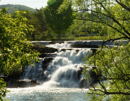
Willsboro Falls, within the Town of Willsboro along the the Bouquet River, is a 25 foot waterfall with a captivating personality.
Hiking
ca742f3a-aeb2-4f0c-9fa8-33d7ce754a21
Stevenson Road, Westport
The Mountain Spring Road Trail is an easy, 8-mile-loop that follows a seasonal road through the Adirondack foothills, known as the West Champlain Hills, to Mineville.
Snowshoeing
3a9fa7bc-39aa-4d77-8688-5f0fec0c9846
Ferris Road POB 193, Whallonsburg
The Field and Forest Trail passes under open hardwoods, crosses a creek, and goes through rolling fields with views of the surrounding mountains.
Hiking
95b9024a-3da9-4ca0-a639-b7ed2b91ab61