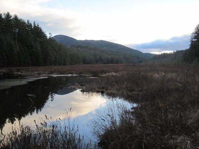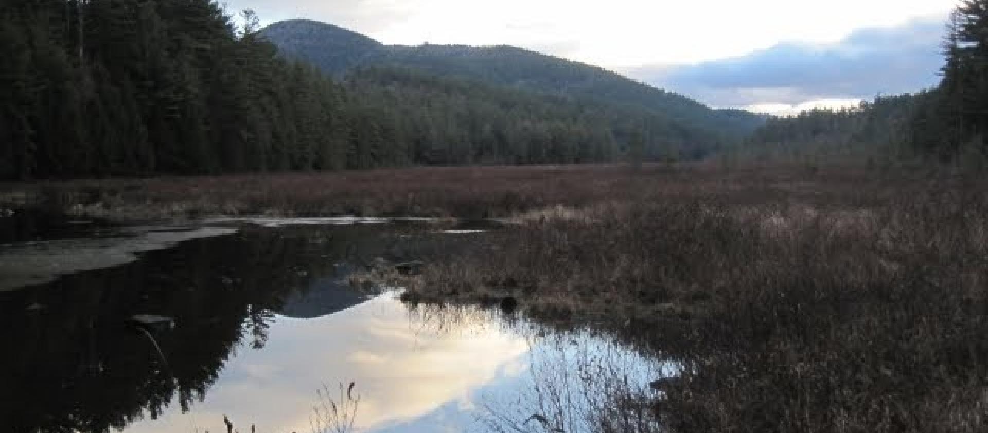
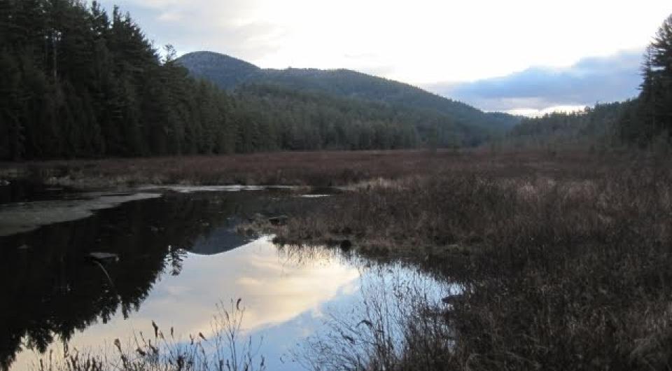
Berrymill Pond
43.837550, -73.571517
Berrymill Pond is a scenic destination with hiking, camping, and paddling in the Pharaoh Lake Wilderness Area.
Key takeaways
- Distance: 4.4 miles round trip
- Elevation gain: 525 feet
- Hike includes trail junctions
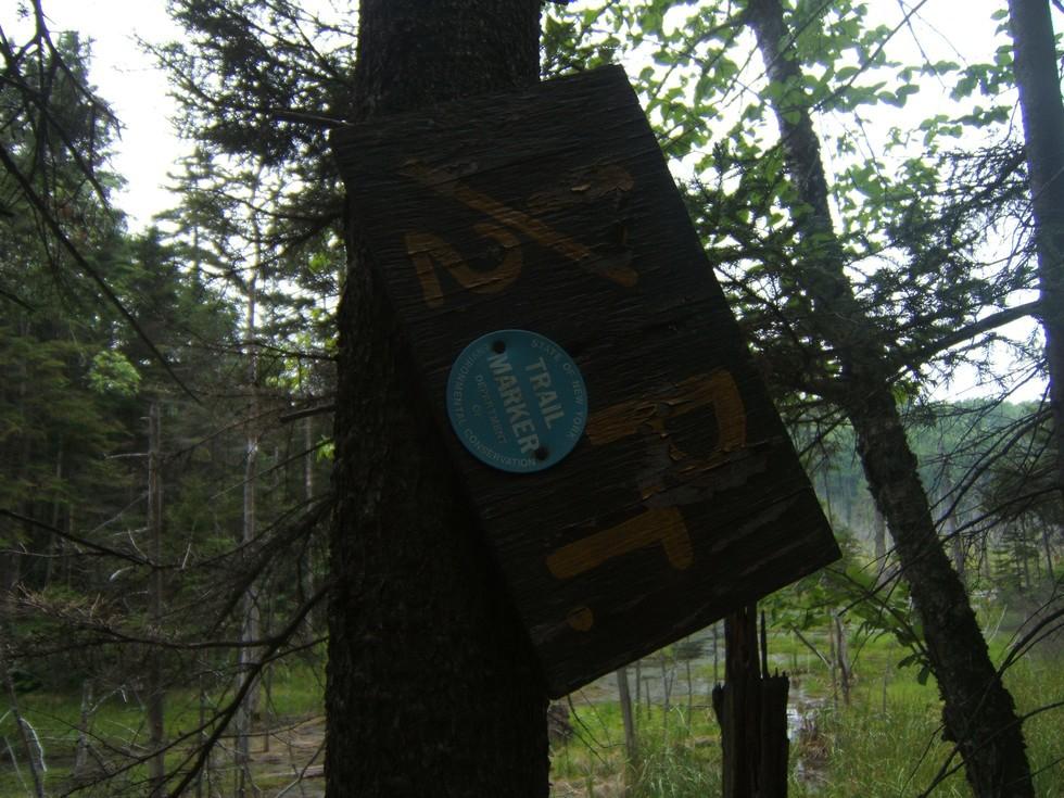
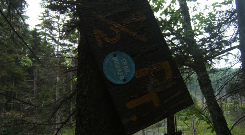
Hiking to Berrymill Pond
Locate the trailhead at the front left of the parking lot just as you enter. From the trailhead you will hike around 445 feet in elevation to reach the shore of Berrymill Pond and the lean-to located there. It is a slow and steady approach. The trail tends to be wet, especially in the spring of the year, so expect a bit of running water in areas.
There is an excellent spot on the peninsula where lunch can be had looking out over the water’s edge. The trail does continue past the pond giving other looks at the water, but eventually you should turn around since the trail would bring you out many, many miles from your car. A second car spot off West Hague Road would be an option for a point-to-point hike, but the highlight of the trail is the pond.
Berrymill Pond in the winter
Depending on where plowing ends, this hike may be a lot longer. Be prepared to walk additional miles on the road. This trail might need to be broken out in the winter, and doesn't get much attention during this time of year, so be prepared for all conditions. This could be a good cross country ski if you have some backcountry experience.
Find more legendary trails in the Lake Champlain Region
Want to find more hikes in the Lake Champlain Region’s open spaces? With the Lake Champlain Region’s extensive trail network, there are endless options to choose from!
Paddling
Wild cranberries, pitcher plants, bears, and great northern water snakes are what may greet you on this paddling adventure. Trails, lean-tos, terrific views of the ponds from campsites included. Not a premier paddling destination, however, due to a 2 mile carry to reach the pond. Still, a nice hike and worth carrying a lightweight (under 20 lbs.) boat if so inclined.
- Pond Size: 40 Acres.
Camping
Quiet setting for camping with a newer lean-to on the south edge of the pond. Camping is also available at the trailhead for this hike, which makes for a great basecamp for more hikes in the area.
How to get there
From the intersection of Route 9N, Route 22 and Route 74 in Ticonderoga follow Route 74 toward Schroon Lake. Continue for just under 5 miles to Putts Pond Road on the left. Follow Putts Pond Road to the end at the Putnam Pond State Campground. Head straight through the booth area and head up the hill, the trailhead will be on the left.
Lean-tos

Packages and Promotions
range
Valid Feb. 13
Valid Feb. 10 - Feb. 13
Valentine's Dinner at The Deer's Head
The Deer's Head Inn
The Deer's Head Inn
Valentine's Day at The Deer's Head Inn Restaurant
Celebrate Valentine’s Day a
promotion
range
Valid Feb. 7
Valid Feb. 3 - Feb. 7
Willsboro Diner's Super Bowl Specials
Willsboro Diner
Willsboro Diner
promotion
range
Valid Mar. 11 - Apr. 2
Valid Mar. 15 - Apr. 2
Boyea's March Madness Specials
March Madness Specials
Celebrate tournament season with March Madness Specials at Boyea’s Grocery & Deli
promotion
range
Valid Feb. 11
Valid Jan. 11 - Feb. 11
Galentine's Day Sip and Shop
Vintage Reimagined
Vintage Reimagined
Vintage Reimagined invites you to join them as they reopen for the first night in 2026; Thursday, February 12 from 5:00-7:00 pm.
promotion
range
Valid Feb. 7
Valid Feb. 1 - Feb. 7
Super Bowl Feast at K&D Deli
K&D Deli and Grocery
K&D Deli and Grocery
Super Bowl Feast
K&D Deli and Grocery are hosting a watching party for the game!
promotion
range
Valid Feb. 13
Valid Feb. 5 - Feb. 13
Valentine's Day at Mountain Dog Restaurant and Pub
Mountain Dog Restaurant & Pub
Mountain Dog Restaurant & Pub
Valentine's Day Special Menu
The event takes place on February 14th from 4:00 pm – 8
promotion
range
Valid Mar. 13
Valid Mar. 8 - Mar. 13
Burleigh's Luncheonette Shades of Green Special
Burleigh's Luncheonette
Burleigh's Luncheonette
Shades of Green Special
Celebrate the flavors of St.
promotion
range
Valid Feb. 13
Valid Feb. 2 - Feb. 13
Valentine's Night at the Pleasant Valley Cafe
Pleasant Valley Café
Pleasant Valley Café
Celebrate Valentine’s Night at The Pleasant Valley Café
Treat your special
promotion
range
Valid Feb. 13
Valid Feb. 5 - Feb. 13
Olde Miners' Tavern Valentine's Day
Olde Miners' Tavern Valentine's Day
Celebrate Valentine’s Day with a special dinner made to impress.
promotion
range
Valid Mar. 15
Valid Mar. 3 - Mar. 15
St. Patrick's Day Bash
Paper and Pencil
Paper and Pencil
Celebrate St. Patrick's Day
Celebrate St.
promotion
range
Valid Feb. 13
Valid Feb. 1 - Feb. 13
Burleigh's Luncheonette Valentine's Dinner
Burleigh's Luncheonette
Burleigh's Luncheonette
Valentine's Dinner
Looking for a place to take your sweetheart? Check out our Valentine's Day dinner specials!
promotion
range
Valid Mar. 13
Valid Feb. 23 - Mar. 13
St. Patrick's Day Karaoke Night
Karaoke Night
Celebrate St.
promotion
range
Valid Jan. 25
Valid Jan. 19 - Jan. 25
Ti Mill Monday
Paper and Pencil
Paper and Pencil
Ti Mill Monday
Dinner, drinks and music with Dan Rabideau, Monday January 26 at The Paper and Pencil. Happy hour starts at 3:00 pm, music
promotion
range
Valid Mar. 14
Valid Mar. 2 - Mar. 14
St. Patrick's Dinner at Adirondack Eagles #4410
promotion
range
Valid Oct. 21 - Apr. 30
Valid Oct. 21 - Apr. 30
Exclusive Indoor Pickleball at The Essex Inn
Essex Inn & Restaurant
Essex Inn & Restaurant
Two miles north of the Inn lies our newly-built, state-of-the art, private indoor pickleball court. “Our new court is the finest indoor pickleball
package
Other, Activities and Attractions
range
Valid Feb. 13
Valid Feb. 8 - Feb. 13
Valentine's Day Specials at Suzie's
Suzie's
Suzie's
Valentine's Day Specials
promotion
range
Valid Feb. 12 - Feb. 13
Valid Feb. 12 - Feb. 13
Valentine's Day special at Essex Ice Cream Cafe
Essex Ice Cream Cafe
Essex Ice Cream Cafe
Enjoy this special all week long
For $20 you can get:
promotion
range
Valid Feb. 7
Valid Feb. 3 - Feb. 7
Super Bowl Specials at Taco Temptation
SUPER BOWL SPECIALS at Taco Temptation!
promotion
Valid
Valid Jan. 29 - Feb. 13
Valentine's Date Night Dinner
Paper and Pencil
Paper and Pencil
promotion
range
Valid Mar. 1 - Mar. 4
Valid Mar. 1 - Mar. 4
Family Deal at Boyea's
Family Deal at Boyea's
Boyea’s Grocery and Deli in Moriah is serving up a Family Deal you won’t want to miss
promotion
range
Valid Feb. 24 - Feb. 27
Valid Feb. 22 - Feb. 27
20¢ Off per Gallon of Gasoline
Avery Energy LLC
Avery Energy LLC
Save on Gas!
promotion
range
Valid Feb. 7
Valid Feb. 3 - Feb. 7
Super Bowl Sunday Specials at Suzie's
Suzie's
Suzie's
Super Bowl Sunday Specials at Suzie’s
Game day calls for big flavor, and Su
promotion
range
Valid Feb. 13
Valid Feb. 5 - Feb. 13
Valentine's at Piper and Pine
Piper & Pine Florals Valentine's Day Specials
Thoughtfully designed blooms for Valentine’s Day
promotion
range
Valid Apr. 14
Valid Apr. 13 - Apr. 14
Unhappy Hour
Mountain Dog Restaurant & Pub
Mountain Dog Restaurant & Pub
Unhappy Hour - Tax Day Therapy
Shake off Tax Day stress at Mountain Dog Restaurant and Pub’s “Unhappy Hour: Tax Day Therapy”!
promotion
range
Valid Jul. 1 - Jul. 4
Valid Jun. 30 - Jul. 4
Celebrate July 4th Week at the Old Dock
The Old Dock Restaurant (Seasonal)
The Old Dock Restaurant (Seasonal)
Celebrate the 4th with great food, live entertainment and stunning waterfront views.
promotion
range
Valid Feb. 7
Valid Feb. 4 - Feb. 7
Grover Hills Deli Super Bowl Specials
Grover Hills Deli
Grover Hills Deli
Super Bowl Specials
Hosting a crowd or keeping it simple?
promotion
recurring
Valid
Valid Feb. 18 - Apr. 2
weekly on Friday until April 3, 2026
Hot Turkey Sandwich Special
Pleasant Valley Café
Pleasant Valley Café
Make Fridays something to look forward to at Pleasant Valley Cafe with their Hot Open-Faced Turkey Sandwich special.
promotion
1
week
FR
FR
range
Valid Feb. 7
Valid Feb. 1 - Feb. 7
Boyea's Super Bowl 2026 Specials
Boyea's Super Bowl 2026 Specials
Boyea's Grocery & Deli is offering 5 dining specials for Super Bowl Sunday.
promotion