Pole Hill Pond Preserve
43.614549, -73.622296
South of the Champlain Valley, Pole Hill Pond Preserve has great loop hikes that are worth the drive. Be aware, the trailhead is difficult to find, so follow the directions closely and print out the brochure to have in hand. The preserve is maintained by the Lake George Land Conservancy (LGLC) and the NYSDEC, and is made up of two loops with excellent payoffs.
Hiking in the Pole Hill Pond Preserve
Bear Knob Loop
Key takeaways
- Distance: 1.35 miles round trip
- Elevation gain: 415 feet
- Hike includes trail junctions
This is the shorter of the two loops and is a bit more rugged than would be expected. The trail is marked in yellow. At about 0.2 miles in, the yellow trail breaks off to the left and continues an easy climb and quickly comes to an unmarked intersection with the Blue Trail up Walnut Ridge. From here the trail takes a sharp right and starts climbing steadily over rough footing at times. The trail is well marked but not used heavily so you will need to look ahead for the next marker and be aware of sharp turns to stay on track. There are nice views along the climb of Walnut Ridge from open rock areas. The actual summit of Bear Knob has what they call seasonal views. From the summit you will descend, at times fairly steeply, back to the blue trail about 0.4 miles from the parking lot.
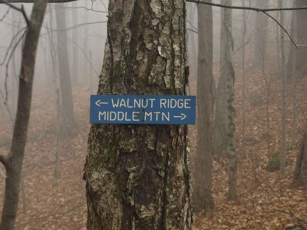
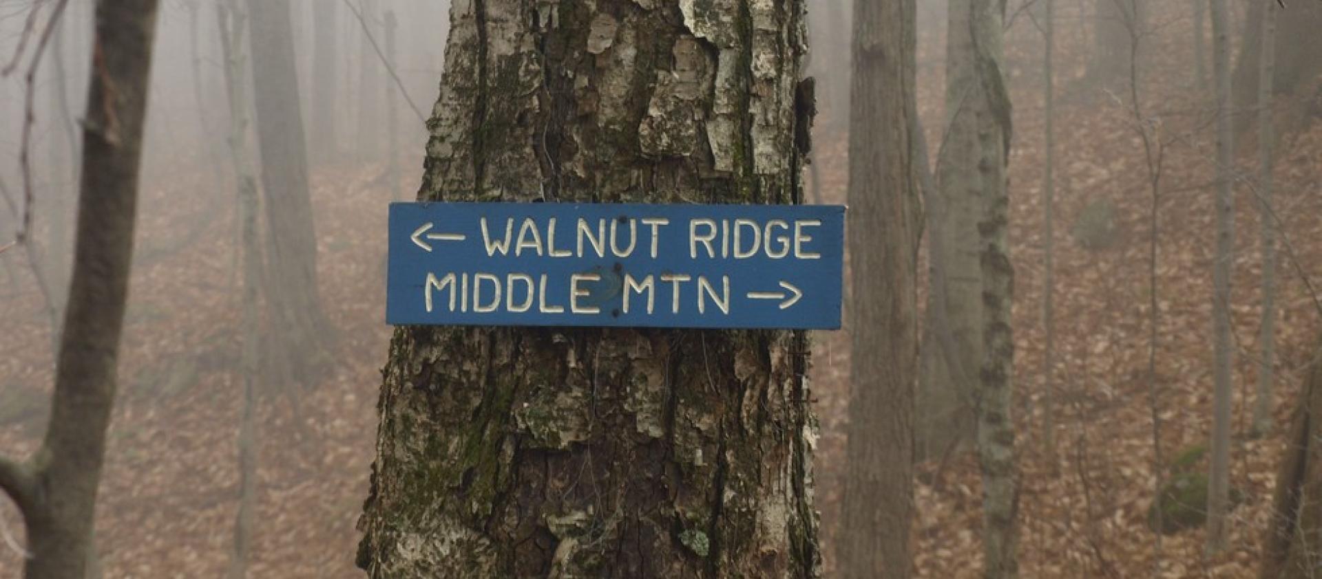
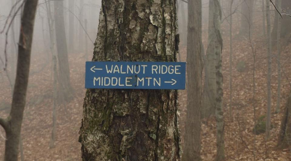
Walnut Ridge Loop
Key takeaways
- Distance: 5.5 miles round trip
- Elevation gain: 1,580 feet
- Hike includes trail junctions and a water crossing
This loop is much longer and fairly demanding. The trail starts out slowly climbing along a stream on old forest road and eventually crosses it before starting a much more demanding climb (the stream crossing can be difficult after a bad rainstorm). The climb is steady and at times a bit steep as you approach the top of Middle Mountain. Middle Mountain is a wooded summit with decent views through the trees and open forest. There is a slight descent from Middle Mountain that will bring you to a col with a sign pointing back to Middle Mountain and ahead to Walnut Ridge. The climb up to Walnut Ridge is the continuation of the loop and is a steep pitch. Once on the ridge the views start to appear and eventually they become quite stellar as you overlook the lake. The open part of the ridge lasts a bit before it descends steadily down to Pole Hill Pond, which is a lovely backcountry gem. From here the trail continues to descend at a steady clip along an old road that brings you down to the yellow trail, which you should follow straight ahead and not uphill toward Bear Knob, unless of course you wish to go there. This is an unmarked intersection, but the blue trail ends at this point. It isn’t all that far back to the other side of the Blue Trail and the trailhead from here.
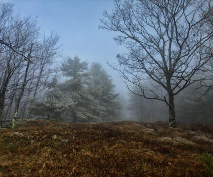
Pole Hill Pond Preserve in the winter
Accessing these trails in the winter may be tough, as parking on the roadside might require shoveling some snow. It is done in the winter, and can make for a secluded hike with trail breaking necessary. As such, if you decide to tackle these trails in the winter, be prepared for all conditions. While this area doesn't get as much snow as the more mountainous portions of the Adirondacks, bring snowshoes, and carry microspikes since many portions of this hike can get icy.
Find more legendary trails in the Lake Champlain Region
Want to find more hikes in the Lake Champlain Region’s open spaces? With the Lake Champlain Region’s extensive trail network, there are endless options to choose from!
How to get there
From the Ticonderoga traffic circle, head south on Route 9N for 23 miles. The trail entrance will be on the right. If you pass the driveway with the stone lions, you have gone too far. The trailhead on Route 9N is not marked, so look for a dirt drive. You may need to park along the roadside as the drive is a bit rough for small cars. There are trail signs and markers at the backside of the drive, but these cannot be seen from the main road.
Keep Exploring

Packages and Promotions
range
Valid Feb. 11
Valid Jan. 11 - Feb. 11
Galentine's Day Sip and Shop
Vintage Reimagined
Vintage Reimagined
Vintage Reimagined invites you to join them as they reopen for the first night in 2026; Thursday, February 12 from 5:00-7:00 pm.
promotion
Valid
Valid Jan. 29 - Feb. 13
Valentine's Date Night Dinner
Paper and Pencil
Paper and Pencil
promotion
range
Valid Nov. 30 - Jan. 3
Valid Nov. 24 - Jan. 3
Sail Champlain in 2026
Sail Adirondacks LLC
Sail Adirondacks LLC
Set Sail on a Lake Champlain Adventure in 2026!
Dreaming of a unique Lake Champlain experience?
promotion
range
Valid Apr. 14
Valid Apr. 13 - Apr. 14
Unhappy Hour
Mountain Dog Restaurant & Pub
Mountain Dog Restaurant & Pub
Unhappy Hour - Tax Day Therapy
Shake off Tax Day stress at Mountain Dog Restaurant and Pub’s “Unhappy Hour: Tax Day Therapy”!
promotion
range
Valid Mar. 13
Valid Mar. 8 - Mar. 13
Burleigh's Luncheonette Shades of Green Special
Burleigh's Luncheonette
Burleigh's Luncheonette
Shades of Green Special
Celebrate the flavors of St.
promotion
range
Valid Feb. 7
Valid Feb. 1 - Feb. 7
Super Bowl Feast at K&D Deli
K&D Deli and Grocery
K&D Deli and Grocery
Super Bowl Feast
K&D Deli and Grocery are hosting a watching party for the game!
promotion
range
Valid Mar. 11 - Apr. 2
Valid Mar. 15 - Apr. 2
Boyea's March Madness Specials
March Madness Specials
Celebrate tournament season with March Madness Specials at Boyea’s Grocery & Deli
promotion
range
Valid Feb. 13
Valid Feb. 10 - Feb. 13
Valentine's Dinner at The Deer's Head
The Deer's Head Inn
The Deer's Head Inn
Valentine's Day at The Deer's Head Inn Restaurant
Celebrate Valentine’s Day a
promotion
range
Valid Mar. 13
Valid Feb. 23 - Mar. 13
St. Patrick's Day Karaoke Night
Karaoke Night
Celebrate St.
promotion
range
Valid Feb. 13
Valid Feb. 8 - Feb. 13
Valentine's Day Specials at Suzie's
Suzie's
Suzie's
Valentine's Day Specials
promotion
range
Valid Feb. 13
Valid Feb. 5 - Feb. 13
Valentine's at Piper and Pine
Piper & Pine Florals Valentine's Day Specials
Thoughtfully designed blooms for Valentine’s Day
promotion
range
Valid Feb. 7
Valid Feb. 1 - Feb. 7
Boyea's Super Bowl 2026 Specials
Boyea's Super Bowl 2026 Specials
Boyea's Grocery & Deli is offering 5 dining specials for Super Bowl Sunday.
promotion
range
Valid Feb. 7
Valid Feb. 4 - Feb. 7
Grover Hills Deli Super Bowl Specials
Grover Hills Deli
Grover Hills Deli
Super Bowl Specials
Hosting a crowd or keeping it simple?
promotion
range
Valid Mar. 15
Valid Mar. 3 - Mar. 15
St. Patrick's Day Bash
Paper and Pencil
Paper and Pencil
Celebrate St. Patrick's Day
Celebrate St.
promotion
range
Valid Feb. 7
Valid Feb. 3 - Feb. 7
Super Bowl Specials at Taco Temptation
SUPER BOWL SPECIALS at Taco Temptation!
promotion
range
Valid Feb. 13
Valid Feb. 2 - Feb. 13
Valentine's Night at the Pleasant Valley Cafe
Pleasant Valley Café
Pleasant Valley Café
Celebrate Valentine’s Night at The Pleasant Valley Café
Treat your special
promotion
range
Valid Feb. 12 - Feb. 13
Valid Feb. 12 - Feb. 13
Valentine's Day special at Essex Ice Cream Cafe
Essex Ice Cream Cafe
Essex Ice Cream Cafe
Enjoy this special all week long
For $20 you can get:
promotion
range
Valid Feb. 23 - Feb. 28
Valid Feb. 23 - Feb. 28
Weekly Specials at Old Miners Tavern
Old Miners Tavern
Old Miners Tavern
Specials
The Old Miners Tavern is serving up comforting favorites in this week’s specials, available Tuesday
promotion
range
Valid Feb. 7
Valid Feb. 3 - Feb. 7
Super Bowl Sunday Specials at Suzie's
Suzie's
Suzie's
Super Bowl Sunday Specials at Suzie’s
Game day calls for big flavor, and Su
promotion
range
Valid Feb. 13
Valid Feb. 1 - Feb. 13
Burleigh's Luncheonette Valentine's Dinner
Burleigh's Luncheonette
Burleigh's Luncheonette
Valentine's Dinner
Looking for a place to take your sweetheart? Check out our Valentine's Day dinner specials!
promotion
range
Valid Feb. 13
Valid Feb. 5 - Feb. 13
Olde Miners' Tavern Valentine's Day
Olde Miners' Tavern Valentine's Day
Celebrate Valentine’s Day with a special dinner made to impress.
promotion
range
Valid Feb. 24 - Feb. 27
Valid Feb. 22 - Feb. 27
20¢ Off per Gallon of Gasoline
Avery Energy LLC
Avery Energy LLC
Save on Gas!
promotion
range
Valid Mar. 14
Valid Mar. 2 - Mar. 14
St. Patrick's Dinner at Adirondack Eagles #4410
promotion
range
Valid Feb. 7
Valid Feb. 3 - Feb. 7
Willsboro Diner's Super Bowl Specials
Willsboro Diner
Willsboro Diner
promotion
range
Valid Jan. 25
Valid Jan. 19 - Jan. 25
Ti Mill Monday
Paper and Pencil
Paper and Pencil
Ti Mill Monday
Dinner, drinks and music with Dan Rabideau, Monday January 26 at The Paper and Pencil. Happy hour starts at 3:00 pm, music
promotion
recurring
Valid
Valid Feb. 18 - Apr. 2
weekly on Friday until April 3, 2026
Hot Turkey Sandwich Special
Pleasant Valley Café
Pleasant Valley Café
Make Fridays something to look forward to at Pleasant Valley Cafe with their Hot Open-Faced Turkey Sandwich special.
promotion
1
week
FR
FR
range
Valid Mar. 1 - Mar. 4
Valid Mar. 1 - Mar. 4
Family Deal at Boyea's
Family Deal at Boyea's
Boyea’s Grocery and Deli in Moriah is serving up a Family Deal you won’t want to miss
promotion
range
Valid Jul. 1 - Jul. 4
Valid Jun. 30 - Jul. 4
Celebrate July 4th Week at the Old Dock
The Old Dock Restaurant (Seasonal)
The Old Dock Restaurant (Seasonal)
Celebrate the 4th with great food, live entertainment and stunning waterfront views.
promotion
range
Valid Feb. 13
Valid Feb. 5 - Feb. 13
Valentine's Day at Mountain Dog Restaurant and Pub
Mountain Dog Restaurant & Pub
Mountain Dog Restaurant & Pub
Valentine's Day Special Menu
The event takes place on February 14th from 4:00 pm – 8
promotion
range
Valid Oct. 21 - Apr. 30
Valid Oct. 21 - Apr. 30
Exclusive Indoor Pickleball at The Essex Inn
Essex Inn & Restaurant
Essex Inn & Restaurant
Two miles north of the Inn lies our newly-built, state-of-the art, private indoor pickleball court. “Our new court is the finest indoor pickleball
package
Other, Activities and Attractions