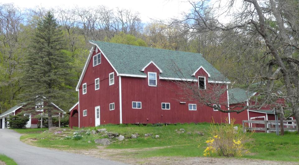
Lewis - Gravel Cycling - Difficult
44.275027, -73.565574
Cycle around the region
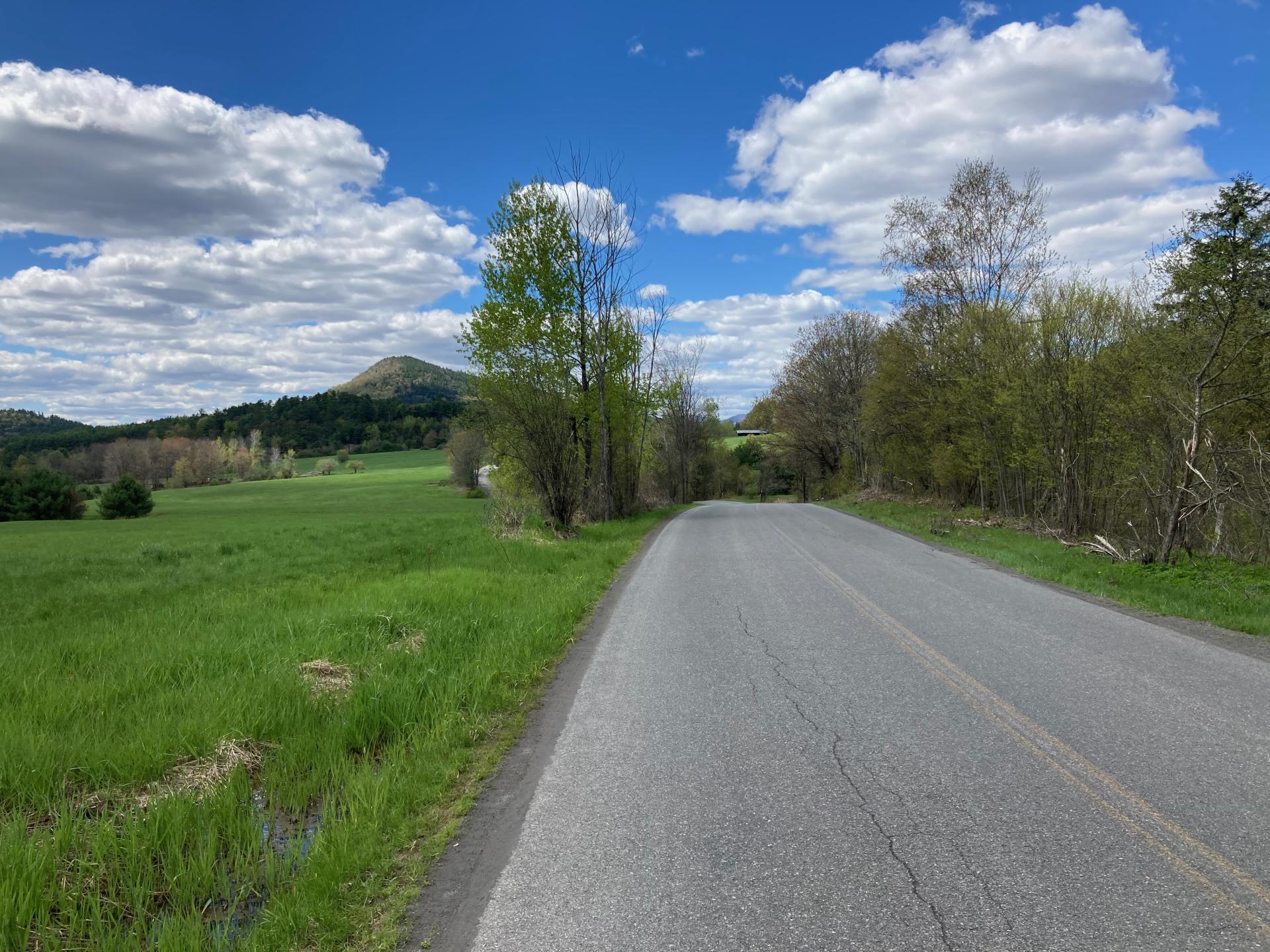
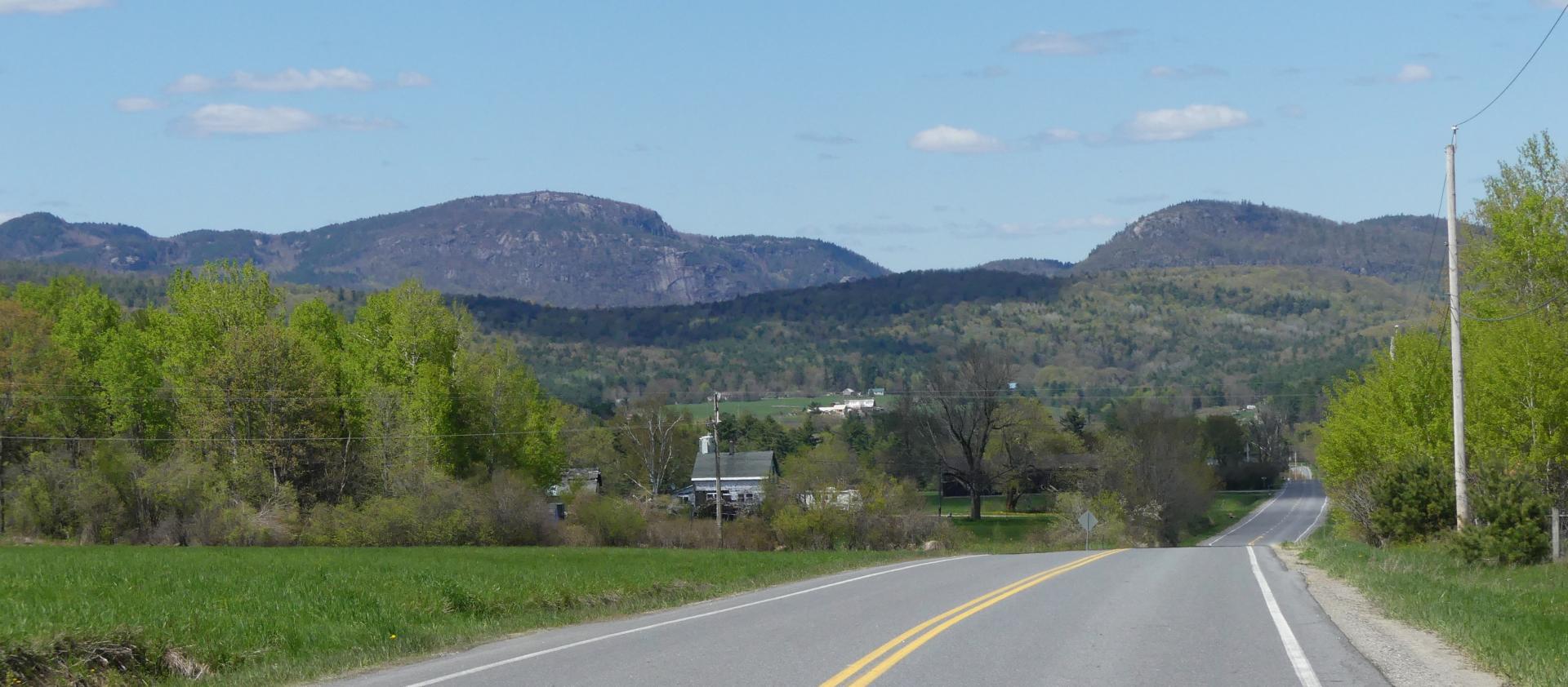
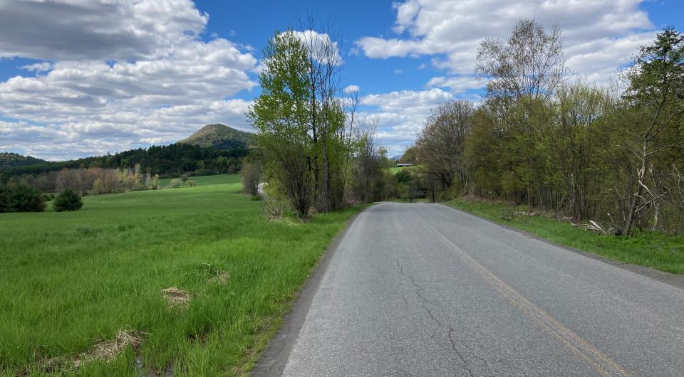
Like Adirondack weather, this ride is constantly changing, and it has a bit of everything. This route has shady forested dirt roads, smooth gravel, quiet paved country roads, and is accompanied by views of open farmland, forests, rivers, and rugged mountains.
How to get there
This ride begins across the road from the Elizabethtown - Lewis Emergency Squad facility which is located 2.5 miles north of Elizabethtown on New York State Route 9. Parking is best 200 feet off the state highway on Steel Woods Road, where the electric utility right of way crosses Steel Woods Road. (Coordinates: 44.246619, -73.566599)
By the numbers
- Level of difficulty: Difficult
- Route length: 23.6 miles (38 kilometers)
- Elevation gain/loss: 1,807 feet (551 meters)
- Smooth country roads, gravel, dirt
A route always changing
This is a good long loop that is fun to ride because everything is continually changing. The ride bounces between unpaved and paved surfaces, climbs and descents, and forests and fields. After starting out easily with a gentle drop on a good gravel road that snuggles up to the Boquet River for a stretch, pavement then sweeps you beneath the Adirondack Northway. As you pass under the Northway, you leave the sounds of cars and trucks behind and begin your trek across the countryside.
The ride to the start of Hurley Road gets you warmed up for the climb up Hurley Road, a rather rugged dirt road that passes through a dense hemlock and hardwood forest. From here you connect with Hyde Road, and after a few hundred feet of climbing you begin a descent that propels you to the bottom of Mason Road and over Spruce Mill Brook. At this point the landscape begins to transition to open agriculture featuring views of the distant mountains from the small historic community of Reber.
Crossing the Boquet River in Reber is the mid-point of the ride and it also marks the lowest elevation of the ride. Just like the first half, from here the ride continues to switch between climbs, descents, pavement and gravel. At about the 20.5 mile mark, you’ll again cross the Adirondack Northway. This time the experience is different as Hyde Road passes above the highway, giving you a great view along the interstate. But the ride isn’t over yet, a short time later you are again treated to a stretch of good gravel which blissfully encourages you back to where you started.
Due to limited cellular coverage, please be sure to download this route and save for offline use before you leave home.

Packages and Promotions
range
Valid Feb. 12 - Feb. 13
Valid Feb. 12 - Feb. 13
Valentine's Day special at Essex Ice Cream Cafe
Essex Ice Cream Cafe
Essex Ice Cream Cafe
Enjoy this special all week long
For $20 you can get:
promotion
range
Valid Feb. 13
Valid Feb. 8 - Feb. 13
Valentine's Day Specials at Suzie's
Suzie's
Suzie's
Valentine's Day Specials
promotion
range
Valid Mar. 1 - Mar. 4
Valid Mar. 1 - Mar. 4
Family Deal at Boyea's
Family Deal at Boyea's
Boyea’s Grocery and Deli in Moriah is serving up a Family Deal you won’t want to miss
promotion
range
Valid Feb. 7
Valid Feb. 1 - Feb. 7
Super Bowl Feast at K&D Deli
K&D Deli and Grocery
K&D Deli and Grocery
Super Bowl Feast
K&D Deli and Grocery are hosting a watching party for the game!
promotion
range
Valid Jan. 25
Valid Jan. 19 - Jan. 25
Ti Mill Monday
Paper and Pencil
Paper and Pencil
Ti Mill Monday
Dinner, drinks and music with Dan Rabideau, Monday January 26 at The Paper and Pencil. Happy hour starts at 3:00 pm, music
promotion
range
Valid Apr. 14
Valid Apr. 13 - Apr. 14
Unhappy Hour
Mountain Dog Restaurant & Pub
Mountain Dog Restaurant & Pub
Unhappy Hour - Tax Day Therapy
Shake off Tax Day stress at Mountain Dog Restaurant and Pub’s “Unhappy Hour: Tax Day Therapy”!
promotion
range
Valid Feb. 11
Valid Jan. 11 - Feb. 11
Galentine's Day Sip and Shop
Vintage Reimagined
Vintage Reimagined
Vintage Reimagined invites you to join them as they reopen for the first night in 2026; Thursday, February 12 from 5:00-7:00 pm.
promotion
range
Valid Feb. 13
Valid Feb. 5 - Feb. 13
Valentine's Day at Mountain Dog Restaurant and Pub
Mountain Dog Restaurant & Pub
Mountain Dog Restaurant & Pub
Valentine's Day Special Menu
The event takes place on February 14th from 4:00 pm – 8
promotion
range
Valid Feb. 7
Valid Feb. 4 - Feb. 7
Grover Hills Deli Super Bowl Specials
Grover Hills Deli
Grover Hills Deli
Super Bowl Specials
Hosting a crowd or keeping it simple?
promotion
range
Valid Feb. 13
Valid Feb. 5 - Feb. 13
Valentine's at Piper and Pine
Piper & Pine Florals Valentine's Day Specials
Thoughtfully designed blooms for Valentine’s Day
promotion
range
Valid Mar. 11 - Apr. 2
Valid Mar. 15 - Apr. 2
Boyea's March Madness Specials
March Madness Specials
Celebrate tournament season with March Madness Specials at Boyea’s Grocery & Deli
promotion
range
Valid Mar. 13
Valid Feb. 23 - Mar. 13
St. Patrick's Day Karaoke Night
Karaoke Night
Celebrate St.
promotion
range
Valid Mar. 15
Valid Mar. 3 - Mar. 15
St. Patrick's Day Bash
Paper and Pencil
Paper and Pencil
Celebrate St. Patrick's Day
Celebrate St.
promotion
range
Valid Feb. 13
Valid Feb. 10 - Feb. 13
Valentine's Dinner at The Deer's Head
The Deer's Head Inn
The Deer's Head Inn
Valentine's Day at The Deer's Head Inn Restaurant
Celebrate Valentine’s Day a
promotion
range
Valid Jul. 1 - Jul. 4
Valid Jun. 30 - Jul. 4
Celebrate July 4th Week at the Old Dock
The Old Dock Restaurant (Seasonal)
The Old Dock Restaurant (Seasonal)
Celebrate the 4th with great food, live entertainment and stunning waterfront views.
promotion
range
Valid Feb. 7
Valid Feb. 3 - Feb. 7
Willsboro Diner's Super Bowl Specials
Willsboro Diner
Willsboro Diner
promotion
range
Valid Feb. 13
Valid Feb. 1 - Feb. 13
Burleigh's Luncheonette Valentine's Dinner
Burleigh's Luncheonette
Burleigh's Luncheonette
Valentine's Dinner
Looking for a place to take your sweetheart? Check out our Valentine's Day dinner specials!
promotion
Valid
Valid Jan. 29 - Feb. 13
Valentine's Date Night Dinner
Paper and Pencil
Paper and Pencil
promotion
range
Valid Feb. 24 - Feb. 27
Valid Feb. 22 - Feb. 27
20¢ Off per Gallon of Gasoline
Avery Energy LLC
Avery Energy LLC
Save on Gas!
promotion
range
Valid Mar. 14
Valid Mar. 2 - Mar. 14
St. Patrick's Dinner at Adirondack Eagles #4410
promotion
range
Valid Feb. 7
Valid Feb. 1 - Feb. 7
Boyea's Super Bowl 2026 Specials
Boyea's Super Bowl 2026 Specials
Boyea's Grocery & Deli is offering 5 dining specials for Super Bowl Sunday.
promotion
range
Valid Feb. 13
Valid Feb. 2 - Feb. 13
Valentine's Night at the Pleasant Valley Cafe
Pleasant Valley Café
Pleasant Valley Café
Celebrate Valentine’s Night at The Pleasant Valley Café
Treat your special
promotion
recurring
Valid
Valid Feb. 18 - Apr. 2
weekly on Friday until April 3, 2026
Hot Turkey Sandwich Special
Pleasant Valley Café
Pleasant Valley Café
Make Fridays something to look forward to at Pleasant Valley Cafe with their Hot Open-Faced Turkey Sandwich special.
promotion
1
week
FR
FR
range
Valid Nov. 30 - Jan. 3
Valid Nov. 24 - Jan. 3
Sail Champlain in 2026
Sail Adirondacks LLC
Sail Adirondacks LLC
Set Sail on a Lake Champlain Adventure in 2026!
Dreaming of a unique Lake Champlain experience?
promotion
range
Valid Oct. 21 - Apr. 30
Valid Oct. 21 - Apr. 30
Exclusive Indoor Pickleball at The Essex Inn
Essex Inn & Restaurant
Essex Inn & Restaurant
Two miles north of the Inn lies our newly-built, state-of-the art, private indoor pickleball court. “Our new court is the finest indoor pickleball
package
Other, Activities and Attractions
range
Valid Feb. 23 - Feb. 28
Valid Feb. 23 - Feb. 28
Weekly Specials at Old Miners Tavern
Old Miners Tavern
Old Miners Tavern
Specials
The Old Miners Tavern is serving up comforting favorites in this week’s specials, available Tuesday
promotion
range
Valid Feb. 7
Valid Feb. 3 - Feb. 7
Super Bowl Sunday Specials at Suzie's
Suzie's
Suzie's
Super Bowl Sunday Specials at Suzie’s
Game day calls for big flavor, and Su
promotion
range
Valid Feb. 13
Valid Feb. 5 - Feb. 13
Olde Miners' Tavern Valentine's Day
Olde Miners' Tavern Valentine's Day
Celebrate Valentine’s Day with a special dinner made to impress.
promotion