Submitted by Guest Blogger: Kathleen McLoud
The day was basically clear, with beautiful blue skies and puffy white clouds here and there. The temperatures where in the high 70s — the perfect day for a few short to moderate and basically easy hikes in our immediate area of Lake Champlain Region. My friend and co-hiker decided we should take a light lunch and plenty of water, which made our backpacks light and easy to carry. Next we put on the white socks and pulled them up over our light colored long pants. My white long sleeve shirt and her light green shirt where just perfect for the weather and mountain climbing. We put on our hats, sunglasses, and bug spray and were ready for a fun morning.
Belfry Mountain Trail
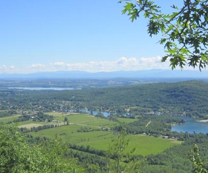
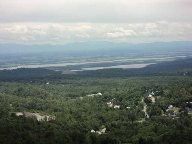
The first trail on our scheduled trip was going to be the easiest and shortest one, Belfry Mountain. Since it’s only 0.35 miles it seemed to be the starting point where we could get our legs and backs warmed up for the other trails. The road was gravel with a fire tower at the end. The views of the Green Mountains of Vermont and the lovely Champlain Valley made the short hike worth the trip. This would be a nice family walk; even with young children it would not be very difficult.
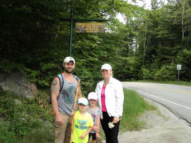
In fact, we met a family of four as we started the hike. The climb to the top of the fire tower was amazing and we noted that there was about a 20 degree temperature change from the bottom to the top. The day that we made this hike, we saw a rain storm coming in from the west while we stood at the top of the fire tower. The 360-degree view gave us a remarkable idea of the vastness of the area.
Big Hollow/Coot Hill Trail
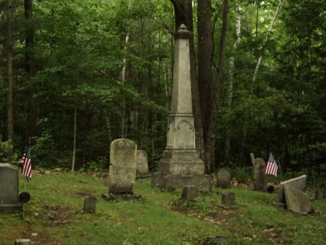
Next on the list is the Coot Hill (Big Hollow) trail. Again, this is an easy 0.5-mile round trip hike. It’s an un-manned portion of Lang Road. Since I have an all-wheel drive vehicle we decided to drive up the dirt road (but there were cars that had made the drive up also). At the end of the dirt road was the Lang cemetery.
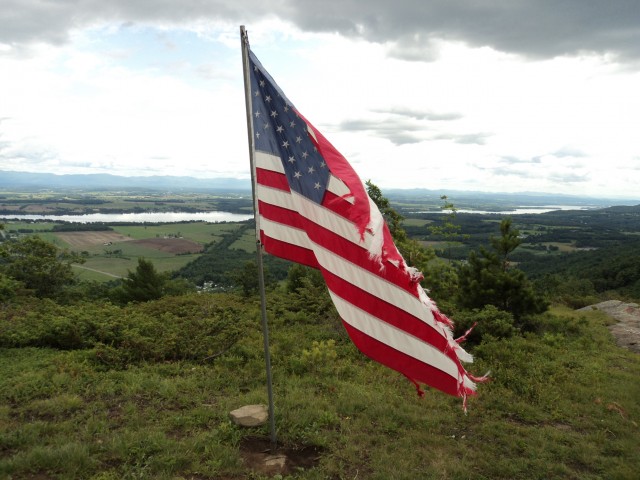
At the beginning of the hike we climbed over some impressive rocks and made it to the top in a short amount of time. The amazing overlook and panoramic view of the Champlain Valley is breathtaking. We even saw a very deep gorge to the left of the mountain. Someone had put an American flag on top and it was blowing in the slight breeze that day. Among the underbrush we spotted several wild blueberry brushes. Now we are both exercised and ready to go to the next spot — a little longer and harder trail.
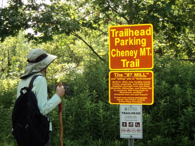
Cheney Mountain Trail
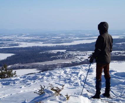
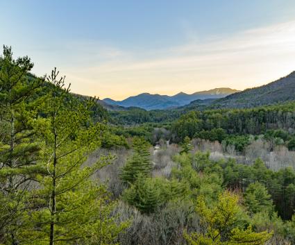
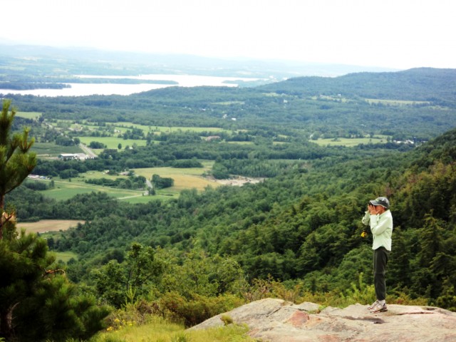
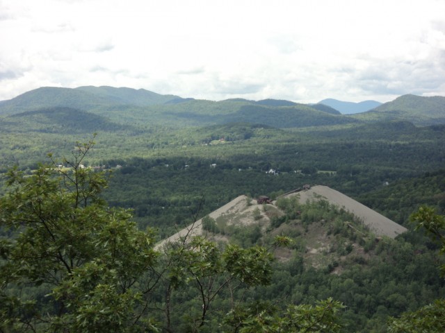
The Cheney Mountain trail is located on property owned by the town of Moriah. It's 2 miles round trip, and the lookouts along the trails have beautiful views of the Adirondack High Peaks as well as the Green Mountains of Vermont. At the top, you are at about 1,347 feet in elevation, which offers a bird's eye view of the beautiful Champlain Valley. As we walked through the field before getting to the trail we spotted some wild strawberries. We hadn’t gotten very far into the hike when my friend noticed a little gnome hiding in between some rocks.
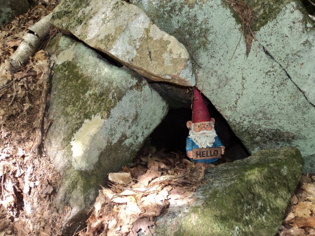
He held a small sign saying “Hello." At the end of this trail you can view the Lake Champlain Bridge to your left, and when you take the path to the right there are tailing piles and old iron ore mines. This was my favorite trail by far. Seeing the bridge from up high and being able to look down on the ore mines was fascinating. I’ve seen the tailings from the road but this gave me a whole new outlook. The High Peaks of the Adirondacks were also mixed into this panoramic view. Amazing hike!
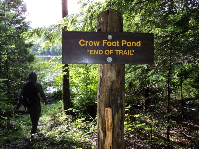
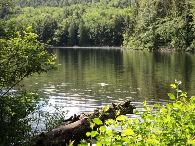
Crowfoot Pond Trail
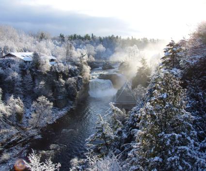
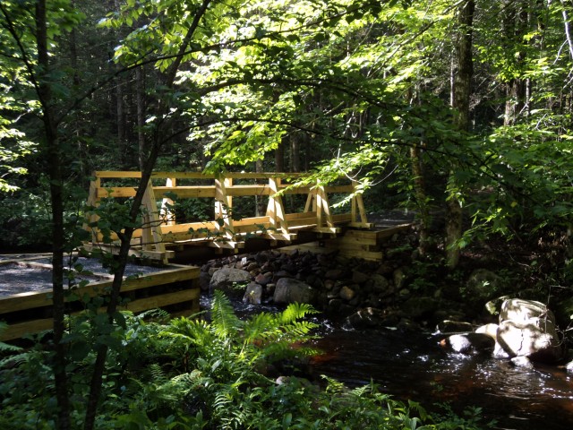
Our last, and by far the longest, trail is the Crowfoot Pond trail. It is located off of Tracy Road near North Hudson. The area itself is basically flat with a slight uphill grade on an old forest road. It changes into a foot path with stately old evergreens all around. Throughout the hike you can see beautiful waterfalls and hear the running water of the nearby streams. We walked over four very nice and well-maintained footbridges.
During our hike we spotted several wild plants and a few salamanders. The 6-mile hike took about four hours and ended at a quiet and peaceful pond surrounded by private property on the north shore. As with any hike, it’s always important to respect the lands that we are so graciously allowed to enjoy.
Ready to get our patches
My friend and I were able to visit and talk about all that we had seen and the beautiful trails that are just in our backyard. Now we have completed the Moriah Hiking Challenge by hiking all four trails: Belfry, Big Hollow/Coot Hill, Cheney, and Crowfoot. Off to Port Henry and the Moriah Chamber of Commerce to get our patches; then everyone will see what a great time we had and want to get a patch themselves.
Thanks to CATS (Champlain Area Trails) for keeping these trails maintained for everyone’s enjoyment. The best part is, they're all close to places to stay and eat.
--
This week in ADK news:
Enjoy winter in Hamilton County
New lodge, historic inspiration