Looking for a great hike to fit into a busy vacation? Last weekend I hiked one of the nicest peaks in the area. Joined by Sophie Gagnon and her companion from Dunham, Quebec I set out to show my visitors as much as I could of the Ticonderoga area. The easiest way to do that is to get up high and see the lay of the land from above.
B & B Breakfast
I started the morning by picking Sophie and Denis up at Sugar Hill Manor Bed and Breakfast in Crown Point where Karen Hennessy had prepared a fantastic breakfast complete with homemade muffins. Sugar Hill Manor is an impeccably kept Victorian home with lots of historic memorabilia and a warm, friendly atmosphere. Unfortunately this B&B closed in 2020. Sophie and Denis were spending a few days and had kayaks on the roof rack and bicycles on the rear rack--definitely ready to rock and roll in the outdoor sense of the expression.
Cook Mountain Preserve
We caravanned to Ticonderoga and parked at the trailhead to Cook Mountain Preserve on Baldwin Road. Cook Mountain Preserve is owned by the Lake George Land Conservancy and is open to the public all year.  We set out on the Yellow trail, crossing the small bridge over the former beaver pond and following the gentle contour of the hillside. We did not check out the new cemetery trail but for those interested in history there are probably local names to see.
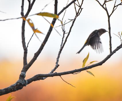
The Ridges Trail begins to go up with only a few steep sections through a beech and maple forest that was full of birds. We heard an ovenbird, a black-throated green warbler and chickadees, all vocalizing in their cheerful ways. There were others but my limited birding ear left their identification until later when I could refer to my bird recordings.
I love this trail because it goes up quickly but fairly painlessly and we got a nice breeze early. Denis is a reptile and amphibian enthusiast so we were glad to find many American toads and a wood frog.  We didn't see any efts or garter snakes on this trip although I've seen them here frequently in the past. The spring wildflowers have finished blooming but there were seedheads on the wild sarsparilla and doll's eyes on the baneberry.
Big Cairn
In a little more than an hour we arrived at the big cairn where many visitors stop to add a rock. In winter the snow causes many of the small rocks to fall but it looks as though someone rebuilt the cairn entirely or many hikers have come this spring and added new height to the pile. This first open ledge gave us a sense of the year's blueberry yield. It seemed less than usual at first but after a quick trek through the woods to the summit we found lots more green fruit, maturing nicely in the sunshine. (Another destination on my blueberry picking list for July.)
The Summit

The summit is an open place without a true view in summer. There were swallowtails and moths flitting around and we stood on the rock that appears to be at the highest elevation (1200 feet or so). Continuing to the end of the Ridges Trail we flushed a mother grouse and her numerous babies. Mother went right and continued to lead us away from six or eight chicks who insecurely grasped the branches of the low oaks. The glades here are incredibly pretty, with low oaks, grassy glades and beautiful lichens on gray and green rocks. At the end of the trail there is a stunning view looking south down Lake George. The renowned Roger's Rock is on the right, or west shore of the lake. 
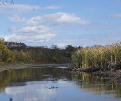
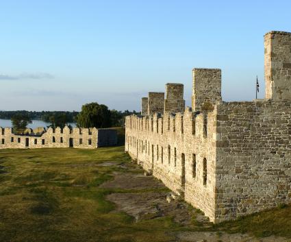
After fruit and chocolate we back-tracked to the summit ledge and turned on the trail that looks east toward Lake Champlain. This view is truly one of the most pastoral scenes in the Champlain Valley. The farms on Baldwin Road were shining with bright green and we looked down over a broad-winged hawk that screeched its wild call. Mount Defiance blocks the view of Fort Ticonderoga but to the north, Lake Champlain matched the blue sky as a foreground for the mountains of Vermont.
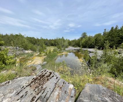
We descended via the same Ridges Trail but stayed left at the bottom on the Yellow Trail, following the edge of the old beaver pond. The beavers are long gone but the land still tells the story. Their dam broke and the water drained and now shrubs and grasses have overtaken the muddy pond bottom. Trees are filling in and below them, the tall grasses and brambles attracted all sorts of butterflies.
In under three hours this hike will satisfy your legs and fill your eyes with long views. From here I took Sophie and Denis through the village of Ticonderoga to the boat launch where they can put their kayaks into the LaChute River. After scouting the put-in they headed to Fort Ticonderoga for the afternoon and I headed north for the farmstand at Streetroad Gardens on the way home.