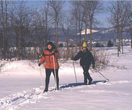
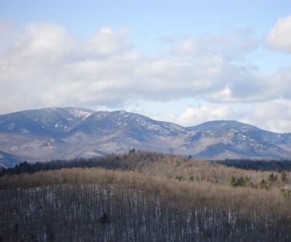
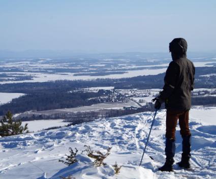
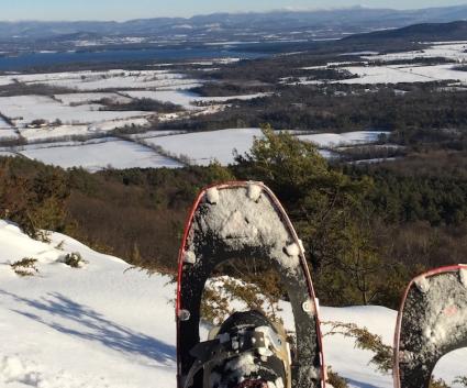
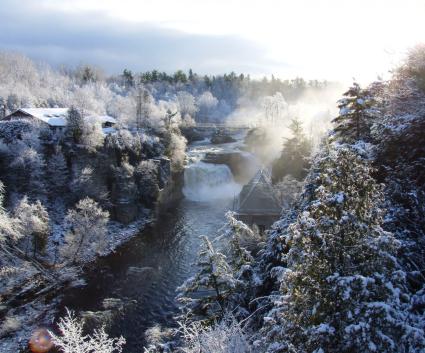
Skiing and Snowshoeing the Champlain Valley
The Champlain Valley is chock-full of unique trails located up and down the Adirondack Coast, but sometimes the best bang for your buck are areas with many trails, loops, and levels of enjoyment. At the five locations I'm going to highlight, you will have the opportunity to XC-ski at all levels, snowshoe as long as your heart desires, and in non-snowy conditions you can trail run, hike, or just sightsee. The important part is to stay active through the hibernation season and don’t give cabin fever a chance to set in. Remember though, this is the cold season and you should be prepared with adequate layers, food, water, and very importantly - a headlamp; because winter days are quite short.
So in no particular order I present to you, a list of five multi-sport trail systems for you and your family's enjoyment.
Split Rock Wild Forest
To get there:
Follow Route 22 north out of Westport. Drive a short distance to Lake Shore Road on your right and follow it. Continue on Lake Shore Road for just under 5 miles to the trailhead on the right.

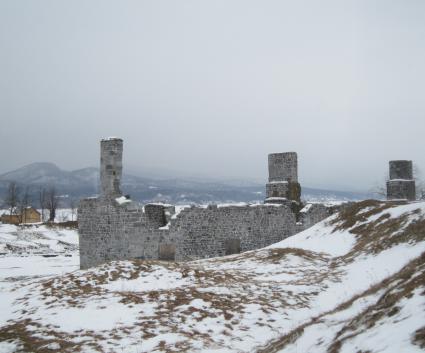
This 3,700-acre wild forest is made up of nine different trails, all of which intersect one another making for nearly countless loops and adventures at your fingertips. All nine trails within this network are perfect for winter activities - some are just harder than others. For example the North Rim Trail that goes over Split Rock Mountain would be considered more of an advanced destination due to its steeper terrain and serious elevation changes, so you might not want to ski this one. While the Robin’s Run, Lewis Clearing Bay, Barn Rock, Gary’s Elbow, Calamity, and Cross-over Trails are all easy to moderate in course and can be the perfect spots to ski or snowshoe.
It’s always nice to have a map of the area you are going in. To download or print out a nice detailed map of the Split Rock Wild Forest go to the NYSDEC website.
Champlain Area Trails (CATS)
The Champlain Area Trails System is made up of over nearly 50-miles of trails that intersect county, town, and dirt roads to connect several small communities. Not all intersect one another but all are within a short reach of one another and these trails vary from 0.25 miles to 4.0 miles round trip offering an expansive range of difficulties. If you're looking for something a bit more demanding to snowshoe be sure to check out Bouquet Mountain, Coot Hill, or Coon Mountains. Maybe you want something slightly easier to strap on the skis and do a bit of kick and glide action? Head to the Midway or Blue Hills Trails. Maybe something easy is on your mind for a newbie to winter sports. The Black Kettle or Bobcat Trail might be the ticket for you. But by all means this only scratches the surface of what’s available, there is so much more is out there. For more information, and maps of the trails, CATS can show you the way.

Wickham Marsh State Game Management Area
To get there:
Follow Route 9 North out of Keeseville and continue to Route 373 on the right that leads to Port Kent. Continue for around 1.5 miles to one of the main entrances on the left.
This trail system is on an 862-acre plot of land where several foot trails have been developed for running, hiking, snowshoeing, cross-country skiing, bird watching, hunting, trapping, fishing and education. But, in the winter you may just have the place to yourself.

While much of the terrain is relatively flat there are a few sections of elevation change. The higher trails tend to stay along the peninsula and overlook the marsh. The ones that descend into the marsh tend to be a bit steeper and can be a bit tough to ski for beginners, but for snowshoeing they are quite nice. The trails within the marsh have excellent varied terrain with rolling hills making for a fun ski. Some of the trails follow old woods roads while others have been newly developed where the tread is much narrower.
Some of the trails have not been adequately marked, so it is very important to have a map with you to avoid confusion. A few of the trails have also gone under slight disrepair but those can be avoided or in some cases even missed. Go to the NYSDEC webpage to download or print out a map.
Blueberry Hill Trails
To get there:
Follow Route 9N out of Elizabethtown toward Keene. Continue for 1.3 miles to Lord Road on the right and turn here. Go only a few hundred feet up Lord Road to one of the main access points on the left.

The Blueberry Hill Trails are located in the Town of Elizabethtown and were built for hiking, snowshoeing, mountain biking, horseback riding, skiing and snowmobiling. Along this trail network you will find a lean-to with outstanding views of the Giant Mountain Wilderness and several other viewing areas: a sugarhouse and a small cabin are also found on the property. There are 30 different trails of different abilities and lengths. Many trails are link-up trails, joining other longer trails. But with such a large network you can plan out many loops with different ability levels in mind.
Many of the trails developed seem to get very light use, making the narrower trails seem more like herd-paths, although they are indeed marked. The terrain is a mix of hilly and flat routes with some following old woods roads leading through passes between adjoining small mounds. Each trail intersection is marked with a trail sign alleviating much of the confusion that might be had, but it is highly recommended that a trail map be carried along. Trail maps can be sometimes found at trailheads but please don’t depend on it. Go to the Elizabethtown Website to download or print out a map.
Pharaoh Mountain Wilderness
There are a great many access points for the Pharaoh Mountain Wilderness: The Putnam Pond State Campground, Long Swing Trail off Route 74, Short Swing Trail off Route 74, and off Crane Pond Road in Schroon Lake. The closest for the Champlain Valley is from the Putnam Pond State Campground, which is a fantastic place to start any cross-country ski or snowshoe excursion. To locate, follow Route 74 out of Ticonderoga and take a left onto Putts Pond Road. Follow this to the end at the campground. Continue through the campground and head up the hill which is straight ahead - the trailhead parking is located on the left.
The Pharaoh Mountain Wilderness is a massive expanse of wilderness, with many, many miles of trails for all abilities. This area of many trails is not so much a trail network but several thousand acres of trails that intersect one another and have wonderful destinations for the eyes.

You can really try out your snowshoe abilities on Treadway Mountain or Pharaoh Mountain. Maybe tone it down a bit with a loop around Putnam Pond, Grizzle Ocean or Rock Pond. With so many trails to choose from you can ski at a beginner’s level to a more experienced level, and the same goes for snowshoeing, hiking, or trail running. Be sure to stop into a local gear shop or and grab a mao for the Pharaoh Mountain Wilderness.