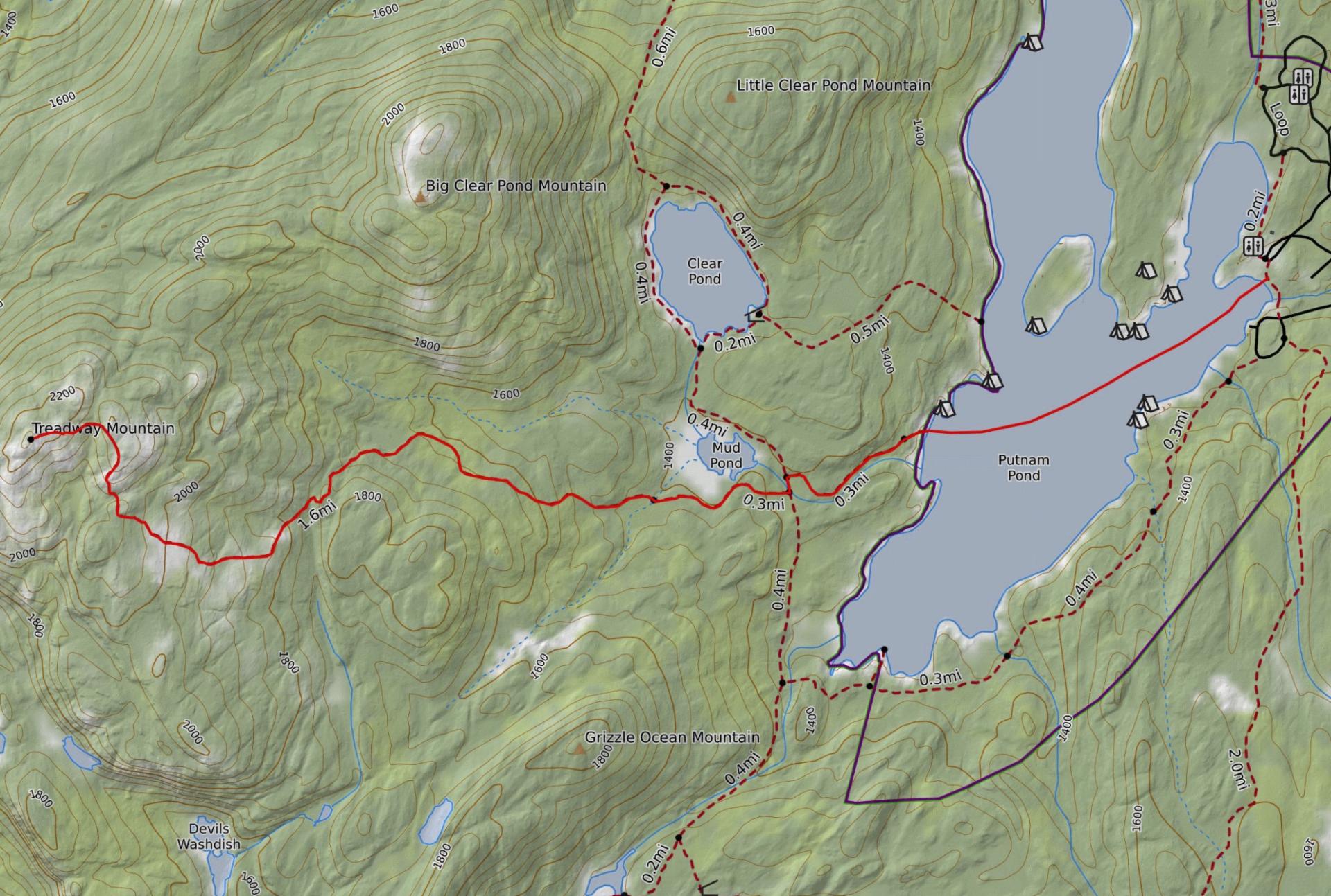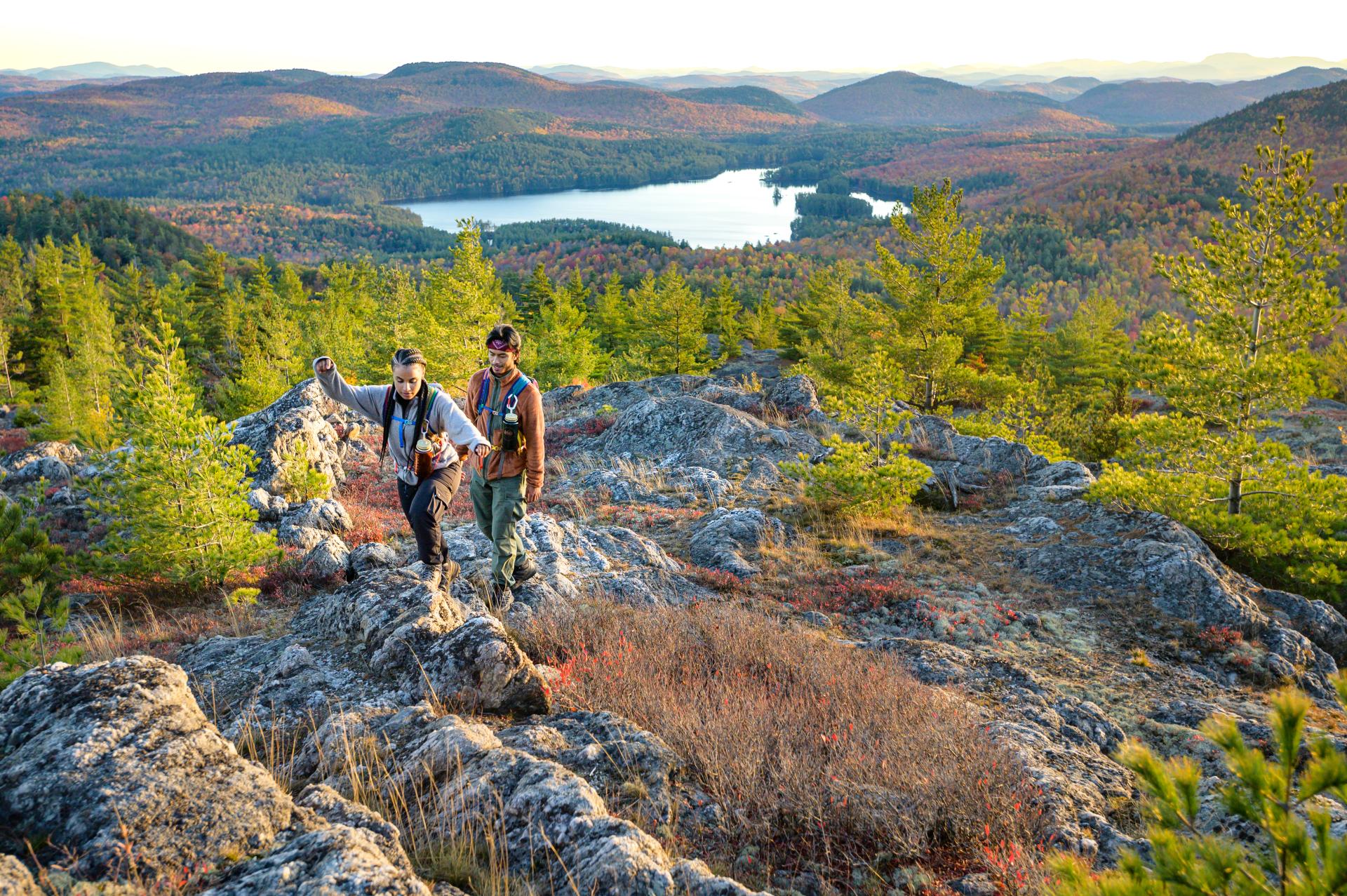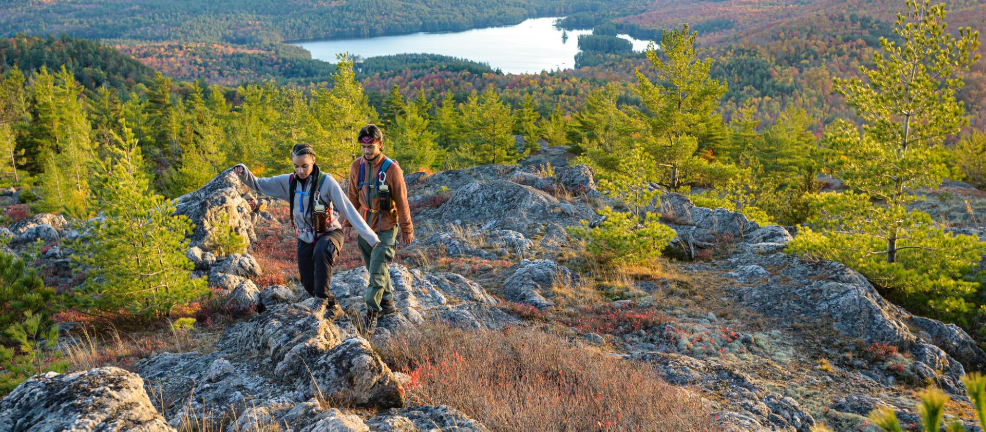
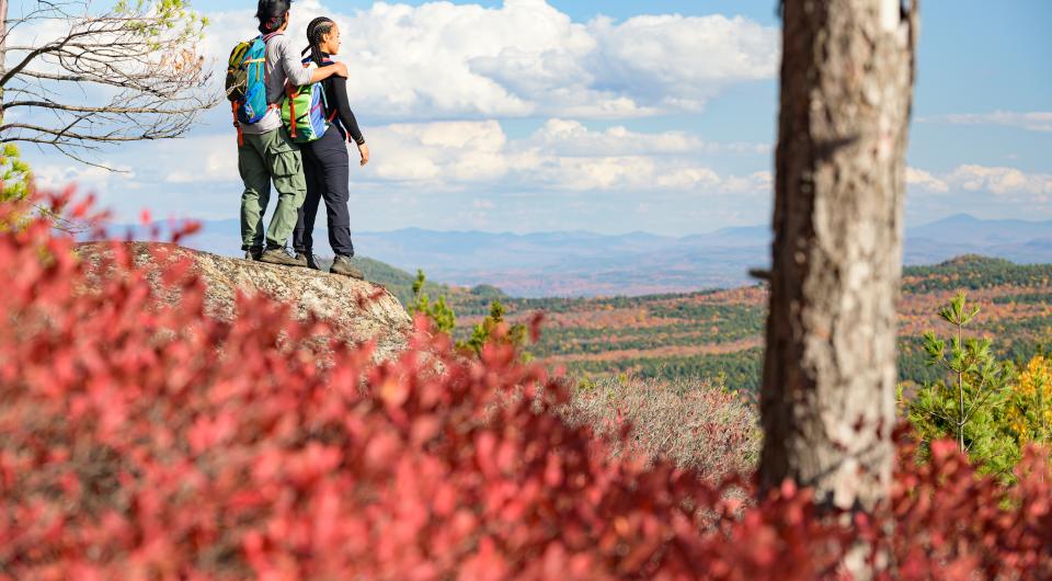
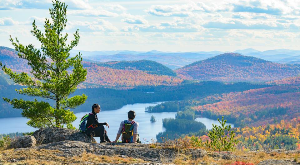
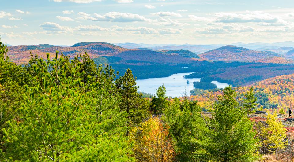
Treadway Mountain
43.837550, -73.571517
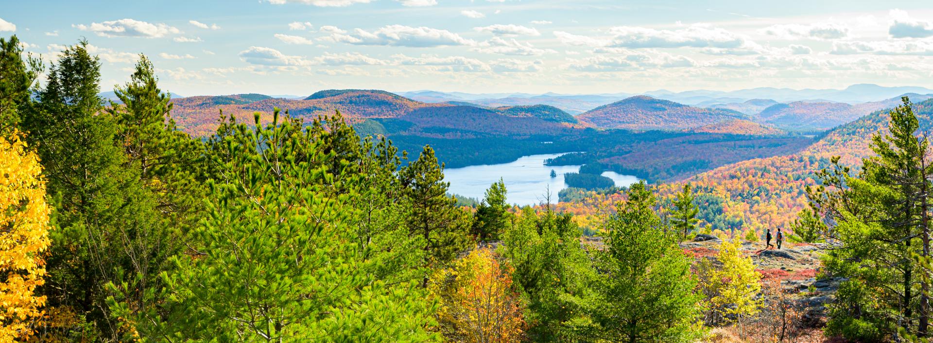
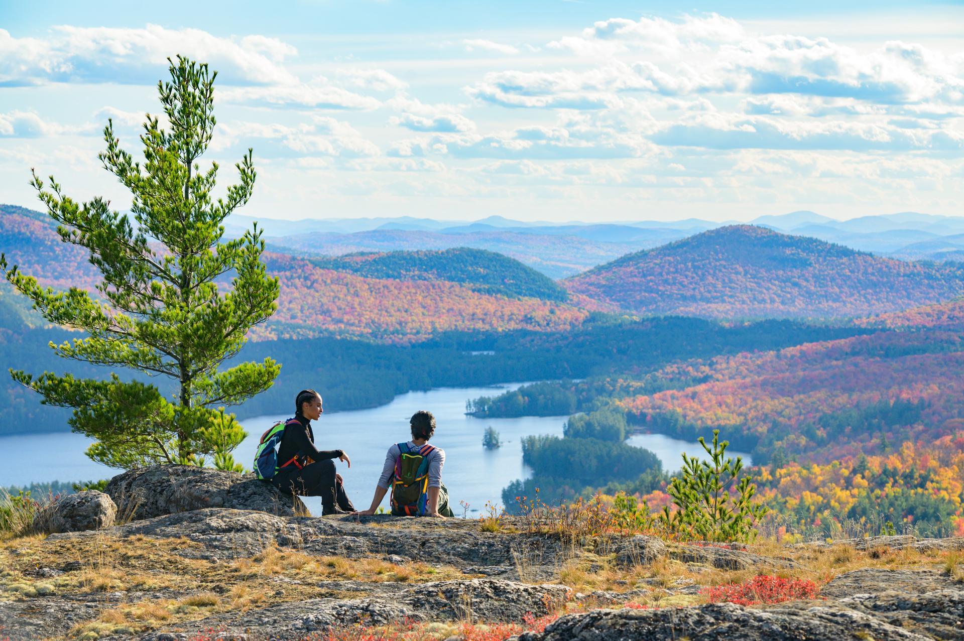
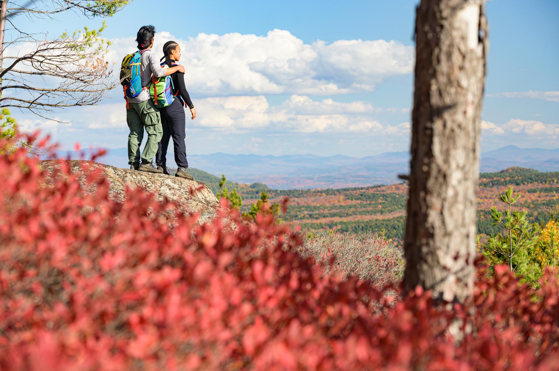
This small peak has some of the best views in the area and is quite a popular hike when the Putnam Pond DEC Campground is open.
How to get there
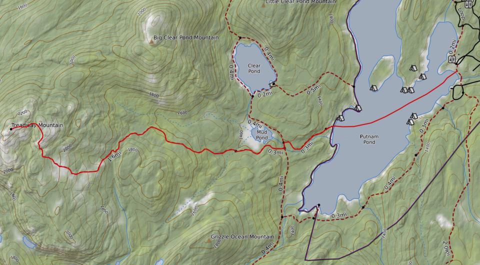
From the intersection of Route 9N, Route 22 and Route 74 in Ticonderoga follow Route 74 toward Schroon Lake. Continue for just under 5 miles to Putts Pond Road on the left. Follow Putts Pond Road to the end at the Putnam Pond State Campground. Head straight through the booth area and head up the hill, the trailhead will be on the left.
By the numbers
- Distance: 3.9 miles, one way
- Mountain elevation: 2,218 feet
- Ascent: 900 feet
Hiking
From the trailhead, start along a flat trail that passes by Putnam Pond passing by a short spur trail that leads to Putnam Pond on your right. There is then a short climb before a rather long descent, which tends to feel even longer on the way out. Soon there is a major intersection on the opposite side of a small bridge and from that intersection take a right, left leads to Grizzle Ocean, another fine destination. Continue around Putnam Pond for a bit longer to another cross-roads; this is where the Treadway Mountain Trail comes in on the left and to the right is another short trail down to Putnam Pond. From here you will start a moderate climb that will swing you through an attractive forest with mixed stands and rocky steps. While the climb is fairly moderate, it will be a 900 foot ascent to the very top. As you approach the summit, many views will start to appear and the summit ridge is an exceptional location for near endless photography.
*A note for winter... depending on where plowing ends, this hike may be a lot longer. Be prepared to walk additional miles on the road.
Paddling
Combine the hike up Treadway with a paddle. Start from the campground and traverse the pond westward to a small bay, where a trail links up with the aforementioned hiking trail.


Packages and Promotions
range
Valid Apr. 3 - Apr. 8
Valid Feb. 21 - Apr. 7
Solar Eclipse Shirts
Small Town Boutique & Dolly & The Bean
Small Town Boutique & Dolly & The Bean
Solar Eclipse Shirts The Small Town Boutique will be offering some SE24 themed shirts for sale during the big event!
promotion
range
Valid Feb. 4 - May. 4
Valid Feb. 21 - May. 4
Spring into a Free Night
Best Western Ticonderoga Inn & Suites
Best Western Ticonderoga Inn & Suites
Stay two nights, earn a free night.
package
Local Deals
range
Valid Apr. 3 - Apr. 7
Valid Feb. 27 - Apr. 8
Montcalm Liquor Solar Eclipse Discount
10% discount on select items!
promotion
Dining Deals
range
Valid Apr. 7
Valid Mar. 21 - Apr. 7
Ticonderoga Area SE24 Business Promotions & Specials
Ticonderoga Area Chamber of Commerce
Ticonderoga Area Chamber of Commerce
Ticonderoga Area Chamber of Commerce Business Promotions and Specials A wide variety of TACC businesses are offering specials and promotions for the Solar Eclipse to take place on Monday, April 8, 2024 including dining and shopping specials and discounts.
promotion
Eclipse ADK 2024, Dining Deals, Shopping Deals
range
Valid Apr. 4 - Apr. 7
Valid Mar. 19 - Apr. 7
Prime Eclipse Time Lodging
Park Motor Inn
Park Motor Inn
Enjoy any 3 nights in this beautiful little apartment between April 5th and April 8th. Prime Eclipse time. Call (518)873-2233 for details.
package
Local Deals
range
Valid Feb. 25 - Feb. 25
Valid Feb. 25 - Nov. 29
Veterans, Military and Government Personnel Discounts
Best Western Ticonderoga Inn & Suites
Best Western Ticonderoga Inn & Suites
Discounts for Veterans, Military and Government Personnel Veterans, Military and Government Personnel enjoy discounts at or below per diem at Best Western(R) Hotels & Resorts throughout North America. Enter your desired destination and dates of travel...
package
Military Discounts
range
Valid Apr. 7
Valid Mar. 27 - Apr. 7
Total Eclipse Prix Fixe
The Deer's Head Inn
The Deer's Head Inn
The Deer's Head Inn is offering a special Prix Fixe for the Total Eclipse on April 8 for $60. To Start: Tuna and Swordfish Skewers or Black Trumpet Mushroom Toast Followed by: Squid Ink Pasta Then choose: Burnt Leek Ash Coated Pork Loin or Black Sea...
promotion
Eclipse ADK 2024, Dining Deals